By Dom Nozzi
This is a slightly edited version of a paper that I wrote and had serialized in 2015 and 2016 in The Blue Line, an online newsletter in Boulder County. I was originally asked to prepare a “transportation white paper” by PLAN-Boulder County, a political advocacy group in Boulder, Colorado. That group ultimately voted to approve this paper as a position paper for transportation.
Contents
Introduction
Economics of Transportation, Part 1, Section 1
Economics of Transportation, Part 2, Section 1
Economics of Transportation, Part 3, Section 1
Urban Design, Part 1, Section 2
Urban Design, Part 2, Section 2
Urban Design, Part 3, Section 2
Regional Transportation and Sustainable Travel, Sections 3 and 4
Recommendations, Section 5
Introduction

Pearl Street Mall, June 2015, Boulder, Colorado. Photo by Dom Nozzi
Many town planners, in recent years, have adopted the tactic of using a rural-to-urban transect for community design. Using this method, communities can equitably provide for the full range of lifestyle and travel choices. A community should provide for those who seek a walkable, compact lifestyle. It should also provide for the more dispersed, low-density lifestyle.
The rural-to-urban transect is a concept that acknowledges that individuals have a range of different lifestyles and forms of travel that they desire. Instead of having a community establish only one set of design regulations and one set of transportation objectives for new development in a community, it is more equitable that regulations and transportation designs be tailored to the full range of choices: walkable for a town center, drivable/bikeable for low-density neighborhoods, and rural/conservation for the periphery of a community.
Not only is this tailored approach much more fair than a one-size-fits-all approach, it is also more resilient: the future is likely to be quite different than today, particularly due to likely resource, financial, demographic, energy and climate changes. Creating a full set of community designs will lessen the impact of significant community shifts to news way of living and getting around, so changes will not be as painful and costly.
In addition, establishing a range of regulatory zones and transportation patterns is more sustainable, politically. Conventionally, the community must engage in endless, angry philosophical battles to determine the most acceptable one-size-fits-all lifestyle and travel preferences (which inevitably mean that the regulations and designs must be watered down to a mediocrity that no one likes—as a way to minimize objections). Instead, when lifestyle zones are established (urban, suburban, rural) and both land use regulations and transportation designs are calibrated differently for each lifestyle zone, political battles are minimized and the regulations and designs can be more pure.

Rural to Urban Transect. Image credit: Duany Plater-Zyberk & Company
There are at least three major transect zones (communities that adopt transect development regulations may have up to 8 zones). Each zone has lifestyle and travel design objectives that are calibrated to promote the lifestyle and travel in question. Design elements that undercut the objectives of a zone are called Transect Violations. The walkable zone strives for relatively compact, human-scaled, slower speed street traffic design. Light fixtures and fences are shorter. Buildings are taller and more likely to mix residences with retail or services. Alignments are more rectilinear, hardscapes typically are emphasized over greenscapes, and landscaping is more formal. Setbacks are smaller. Streets are more narrow and distances between homes and shops are relatively short. Car parking is more scarce and more expensive to use. Densities tend to be higher. In the walkable zone, “more is better.” That is, a walkable lifestyle tends to be higher quality when more housing, retail, services, and culture are added. The drivable/bikeable zone seeks to be more spacious, more private, and densely vegetated. Roads are wider and speeds are higher. Buildings are shorter and usually single-use. Car parking is more abundant and cheaper to use. Setbacks are larger, as are distances between homes and shops. Densities tend to be lower. In the drivable zone, “more is less.” That is, a drivable lifestyle tends to be lower in quality when more housing, retail, services, and culture are added. The rural conservation zone is focused on preservation and is more isolated. Landscaping is relatively naturalistic. Sidewalks and bus service tends to be absent. Speeds are relatively high. Open space, farming, and pasture tend to be abundant.
For Boulder, one might think of the walkable urban zone as Boulder downtown (the “town center”) or Boulder Junction, the drivable/bikable zone as our low density neighborhoods within the urban growth boundary (city limits), and the rural conservation zone as unincorporated Boulder County lands surrounding the city. Similar transects could be constructed for all the cities in Boulder County.
Unfortunately, in most American cities—including Boulder—the supply of walkable, compact housing is far short of demand for such housing (which substantially increases the cost). Conversely, across the nation, there is a larger supply of drivable, more dispersed housing than the demand for such housing (which was recently exemplified by the fact that suburban housing values in most of the nation suffered significantly during the housing crash of the late 2000s). Indeed, communities such as Boulder face a growing housing crisis in the future, as the so-called Millennial generation is less interested in the drivable suburban lifestyle than previous generations.
Considering the current focus on walkable urban development in Boulder, this paper devotes much discussion to what represents the transect zone most in need of improvements: the walkable, compact, existing and emerging town centers in Boulder.
Due to the current demand for this form of lifestyle, Boulder needs to provide substantially more walkable, compact housing in future years to create a balanced housing supply and to increase resilience. However, Boulder has worked hard to create vibrant town centers and to connect lower density areas through our network of frequent buses and Eco Passes, bike and pedestrian walkways, and abundant signed crosswalks and underpasses. This is partly why, for example, those who live and work in Boulder commute by bicycle at a rate 20 times the national average.
This paper, which is organized into four main sections (described below).
Section 1 describes the economics of transportation. Healthy cities need clustering to promote exchange, yet oversized, high-speed roads disperse cities, which undermines exchange. This section describes motorist subsidies, affordability tactics, low-value car trips, efficient parking tactics, congestion and air emissions, and the problem of diminishing returns.
Section 2 describes how urban design shapes and is shaped by transportation. This section addresses the proper sizing of streets, blocks, and intersections, describes the significant problems associated with gigantism, and looks in detail at the merits of right-sizing streets. Also discussed are car speeds, design for safety, problems associated with one-way streets, and suburban sprawl.
Section 3 looks at regional car trips and how to effectively manage them. This section also proposes smart transportation and smart land use tactics.
Section 4 considers sustainable, green travel such as walking, transit, and bicycling. Presented here are effective ways to promote green travel. Concluding remarks address the important need to make people happy, not cars.
____________________________________________
A Transportation Vision for Boulder—Economics of Transportation, Part 1, Section 1

Double left turn intersection at Pearl and 28th, Boulder, Colorado. Photo by Dom Nozzi
Agglomeration Economies and Exchange
Why do cities exist? What makes them healthy? Most urban design professionals and scholars have concluded that cities—particularly their town centers—exist to promote exchange: exchange of goods, services, ideas, and human connection.[1] Similarly, agglomeration economies[2] leverage the synergistic effects of clustering of businesses and people. When higher levels of agglomeration economies are found in a city (i.e., the city is more compact), the city tends to produce more significant innovation, creativity and problem-solving due to the cross-fertilization that agglomeration provides. [3],[4]
The design of transportation in a community has a profound influence over agglomeration and exchange. Larger roads, higher speeds, and abundant free parking undermine agglomeration and exchange; such facilities act as powerful dispersants. Existing and emerging town centers thrive when the pedestrian is the design imperative, and car travel is designed to be secondary. When pedestrian design is emphasized, agglomeration economies and exchange are promoted, as design is compact, low speed, and human-scaled.
In other parts of the community transect, design differs. In lower density areas, road and parking infrastructure are larger, speeds are higher, and development is both more dispersed and lower in profile.
One of the most important transportation problems that Boulder faces is that, like many U.S. cities, car-carrying capacity on some roads has been overbuilt over the years. Excess capacity for car travel induces many car trips that would not have occurred had this large capacity not been built. Large roads directly undermine a great many important Boulder objectives that the city strives to achieve, such as reducing total vehicle miles traveled (VMT) and trips in single-occupant vehicles (SOVs). Oversized roads become flooded with local, non-commuter car trips, and thereby quickly become congested. Expensive efforts to reduce the problems can include road widening, augmenting transit options, and construction of expensive under- or over-passes for motor vehicles, bicyclists and pedestrians. Whereas it makes sense to promote a more financially and physically healthy community by providing more dollars directed toward bicycle, pedestrian and transit improvements, the path of simultaneously overbuilding roads for cars is unsustainable and detrimental to quality of life. A more desirable, affordable and sustainable path is for Boulder to incrementally begin reducing any oversupply of car capacity (particularly in the existing and emerging town centers). Doing this is particularly important if Boulder is to achieve its worthy objective of reducing GHG emissions by 80 percent by 2050. PLAN-Boulder County believes that transportation is a leading lynchpin to high quality of life in Boulder.
Transportation Subsidies and User Fees
Despite arguments to the contrary, motorists do not pay for the costs they impose on society (such as road construction and maintenance, air and water pollution, oil wars, injuries and deaths) because gas taxes and other motor vehicle fees are inadequate to the task.
According to an analysis conducted by the Pew Charitable Trusts Subsidy Scope Project (2009), road user fees paid in the United States—including fuel taxes, vehicle registration fees and tolls—make up a decreasing share of the cost of highway construction and maintenance. The research, based on Federal Highway Administration statistics, concludes that the percentage of revenue coming from road users was 51 percent in 2007, compared with 61 percent in 1997 and 71 percent in 1967. The remaining costs of automobile travel are subsidized by general fund revenues of the city or community.
Other studies[5] have also found large subsidies for autos.
In 2007, Delucchi found that, in the U.S., current tax and fee payments to the government by motor-vehicle users fall short of government expenditures related to motor-vehicle use by approximately 20-70 cents per gallon of all motor fuel. Note that in this accounting, the study included only government expenditures; it did not include any external costs of motor-vehicle use.[6]
That implied subsidy of 28 cents to one dollar a gallon, which excludes social and environmental costs such as climate damage and uncompensated crash costs, equates to 7 to 25 percent of the current price of gasoline.[7] On a dollar basis, according to Delucchi,[8] U.S. drivers are underpaying local, state and national governments by $40 to $105 billion a year.
Free parking is anything but free. As Donald Shoup points out, for example, free parking provided by retailers results in the price of goods and services inside the stores where free parking is located to be higher.[9] The price of goods and services are higher to allow the retailer to pay for the land and maintenance costs of the free parking. If the parking were properly priced—in other words, charging a fair user fee for parking—the price of goods and services inside the stores would be lower.
In addition to the direct car subsidies described above, large subsides for suburban development means that motorists also benefit from artificial cost reductions that further distort the perceived cost of their more remote, car-dependent lifestyle.
For example, the market demand for dispersed, auto-dependent residential property is buoyed by the heavy income tax subsidies for owner-occupied homes, federally-funded wastewater systems, provision of police and fire services, provision of postal and waste diversion services, as well as the road and parking subsidies.
When new developments are built in areas remote from water plants, wastewater plants, and schools, it creates higher incremental (or marginal) costs for adding new capacity to the services. By contrast, the marginal cost of new development near such services is lower. However, because costs are evenly distributed among all citizens by average-cost pricing, those who live in remote locations pay proportionately less. As a result, citizens living in remote, car-dependent locations enjoy an enormous price subsidy courtesy of citizens living closer to the services.
If motorists living in remote suburban locations had to pay the full cost of driving, transit could require less and possibly no subsidy to operate efficiently. There would also be less demand for suburban housing if outlying growth paid more of its fair share of development impacts.
In sum, American motorists (and the drivable suburban lifestyle that many of them live) are among the most heavily subsidized people on earth. Motorists and those in suburban locations pay nowhere near the costs they impose on society. Such a distorted price signal induces a great many Americans to be more interested in living in suburban locations, and they own cars and drive cars a lot more than they otherwise would. Starting to eliminate such motorist welfare would substantially reduce driving, significantly increase bicycling, walking and transit use, reduce air and water pollution, reduce sprawl, increase affordability, improve household and government financial health, improve civic pride, and create more physically healthy communities.
A helpful fee to restore equity and reduce motorist subsidies is a vehicle miles traveled (VMT) fee. A VMT fee, according to Wikipedia,[10] is an alternative to using a gas tax, both of which offer a fairly pure form of user fee, as each obligates the motorist to pay based on how much the road system is used by the motorist. Instead of using a tax on fuel consumption as a way of financing transportation infrastructure, a VMT fee charges motorists based on their road usage measured in mileage. These charges can be either a flat fee (e.g., a fixed number of cents per mile, regardless of where or when the travel occurs) or a variable fee based on considerations such as time of travel, congestion levels on a facility, type of road, type and weight of the vehicle, vehicle emission levels, and ability of the owner to pay. Or it can be a combination of flat and variable fees.
The variable fee is, of course, more fair, since it more accurately measures impacts of driving. For example, variable fees are assessed based on whether the motorist drives at rush hour, how much damage the vehicle is likely to do to the air or roadway, or which route is used.
A VMT fee can monitor travel by using an onboard vehicle device to capture the distance driven by a vehicle through GPS or other technology and relate that to a method of charging, which could involve payments at the gas pump, billing, or automatic deductions for a prepaid customer account. GPS units on board a vehicle can record distance, assign it to the appropriate taxing jurisdiction, and calculate the amount owed. Only the final billing information would have to be released outside the unit, to protect privacy.
Other useful, fair fees include a more comprehensive, market-based, parking pricing program; priced intra-city roads; pay-at-the-pump car insurance; weight-distance fees; mileage-based insurance; mileage-based registration fees; mileage-based emission fees; and gas taxes that are based on a percentage of the price at the pump. If possible, such new taxes/fees should be revenue neutral by reducing or eliminating other fees/taxes when the new user fee is instituted.
Reduced living costs through a reduction in car ownership
The annual cost of car ownership, operation, and maintenance is now well over $9,000 per year. One hundred years ago, transportation was about 2 percent of the overall household budget. Today, household transportation cost—at about 21 percent and rising—is now second only to housing cost for the household budget.
Given this reality, one of the most effective ways to create more affordable housing in Boulder is to design new neighborhoods to reduce travel distances, creating what the Boulder Transportation Master Plan calls the 15-minute neighborhood. Reducing distances can be effectively achieved by sensitively mingling homes with neighborhood-scaled offices and retail that are small enough to not be a bother to nearby residences. Households located in such 15-minute neighborhoods are better able to reduce the number of cars that the household must own.[11] Going from, say, three cars to two, a household will have over $9,000 more each year that it can devote to other expenses, such as the cost of buying or renting a home.
Low-Value Car Trips
There is an essential need for us to recognize that some trips are relatively high-value, and some trips are relatively low-value. A motorist driving a car on a major street at rush hour to buy a sandwich is making a trip that is much lower value than a motorist who is racing to the hospital for a medical emergency. When roads are free of tolls and other direct user fees, roads tend to be flooded with relatively low-value trips. The mistake made too often is that when a community opts to widen a road or intersection if it becomes congested, all of the trips on the road are assumed to be equally high-value.
This is simply not true. Nor is it affordable.
A large number of trips on free-to-use roads are trips for relatively minor tasks such as buying a cup of coffee. Or they are trips that could have occurred on different routes, at different times of day, or by bicycle, walking or transit, rather than by car.
By assuming, as is almost always the case, that all car trips are essential, the community is opting to spend enormous amounts of public dollars to widen a road or intersection to enable or otherwise accommodate such low-value car trips. This sort of worst-case-scenario design is utterly unaffordable and unsustainable from a financial point of view. And helps explain why there is a huge, nearly universal shortfall of transportation revenue throughout the nation, including in Boulder.
Given this, sustainability and financial health requires that Boulder avoid assuming that all trips are equally high in value when it comes to managing congestion. There are much cheaper and fairer ways to manage congestion than by spending many millions of public dollars to widen a road or intersection as a way to accommodate car trips to the coffee shop at rush hour.
The good news is that a community does not need to determine which trips are high-value and which trips are low-value. Citizens are able to make that choice on their own in an efficient, properly designed transportation system. For example, a tolled road or a metered parking space does not prevent a person from driving a car on a major road at rush hour to buy a cup of coffee. That option still exists. But many citizens will voluntarily decide that it would be better to walk, bike, or bus to get that cup of coffee. Or travel on a side road to get it. Or drive at a non-rush hour time to buy the coffee.
References for this section
[1] http://en.wikipedia.org/wiki/Economies_of_agglomeration. See also: Community Design and the Culture of Cities: The Crossroad and the Wall, by Eduardo E. Lozano. And: Making America: The Society & Culture of the United States, edited by Luther S. Luedtke. And: Cities as Sustainable Ecosystems: Principles and Practices, by Peter Newman, Isabella Jennings.
[2] Agglomeration economies are the benefits that a town center or a business experiences when development is compactly located close together – or when a business is locating near supportive or beneficially related businesses (‘agglomerating’). When businesses or community functions cluster together, their costs go down and ideas or innovations or creativity synergistically increase. Cities form, and become more healthy and vibrant, when they take advantage of economies of agglomeration. See: http://en.wikipedia.org/wiki/Economies_of_agglomeration.
[3] Carlino, Gerald, Satyajit, Chatterjee, and Robert Hunt. Working Paper NO. 06-14. Urbn Density and the Rate of Invention. Federal Reserve Bank of Philadelphia, August 2006.
[4] Kundsen, Brian, Richard Florida, Gary Gates, and Kevin Stolarick. Urban Density, Creativity, and Innovation. May 2007.
[5] Delucchi, M. (Inst. of Transportation Studies, UC Davis, CA 95616) (1996). A Total Cost of Motor-Vehicle Use. Access, Spring 1996.
Ketcham, B. & C. Komanoff (1992). Win-Win Transportation: A No-Losers Approach To Financing Transport in New York City and the Region. KEA, 270 Lafayette #400, New York 10012; July 1992.
Litman, T. (1998). Transportation Cost Analysis; Techniques, Estimates and Implications. Victoria Transport Policy Institute, 1250 Rudlin Street, Victoria, BC, V8V 3R7, Canada.
Litman, T. & E. Doherty (2009). Transportation Cost and Benefit Analysis Techniques, Estimates and Implications. VTPI.
Litman, T. (2013). Whose Roads? Evaluating Bicyclists’ and Pedestrians’ Right to Use Public Roadways. 11 December 2013. Victoria Transport Policy Institute. http://www.vtpi.org/whoserd.pdf
MacKenzie, J., R. Dower & D. Chen (1992). The Going Rate: What It Really Costs To Drive. World Resources Institute, 1709 New York Ave NW, Washington DC 20006; June 1992.
Miller, P. & J. Moffet (1993). The Price of Mobility. Natural Resources Defense Council, 71 Stevenson l #1825, San Francisco CA 94105, 415-777-0220; Oct 1993.
Office of Technology Assessment (1994). Saving Energy in U.S. Transportation. U.S. Congress, OTA-ETI-589.
Sierra Club. America’s Autos On Welfare in 2010: A Summary of Subsidies. http://vault.sierraclub.org/sprawl/articles/subsidies.pdf
[6] Such as air, water or noise pollution, the cost of protecting oil deposits overseas, etc.
[7] Assuming gasoline costs $4 per gallon.
[8] Delucchi, M. (Inst. of Transportation Studies, UC Davis, CA 95616) (1996). A Total Cost of Motor-Vehicle Use. Access, Spring 1996.
[9] Shoup, Donald (2005). The High Cost of Free Parking. Planners Press/American Planning Association.
[10] (http://en.wikipedia.org/wiki/Vehicle_miles_traveled_tax)
[11] Walkscore.com uses a 5-minute walking distance for its measurements of walkability. The Walk Score algorithm awards points based on the distance to the closest amenity in each category. If the closest amenity in a category is within one-quarter mile (about a 5-minute walk), Walk Score assigns the maximum number of points. The number of points declines as the distance approaches one mile (about a 20- to 30-minute walk) – no points are awarded for amenities farther than 1 mile. Each category is weighted equally and the points range from 0–100. A score of 70 or more is considered very walkable. The number of nearby amenities is the leading predictor of whether people walk. Relevant amenities include businesses, parks, theaters, schools and other common destinations.
__________________________________________________
A Transportation Vision for Boulder—Economics of Transportation, Part 2, Section 1

Safeway parking lot at 28th and Arapahoe, Boulder, Colorado. July 2015. Photo by Dom Nozzi
Efficient Parking
American cities, including Boulder, tend to provide extremely inefficient parking. That is, most all parking tends to be underpriced or free to use. Little if any parking is shared between nearby land uses (such as a church and a coffee shop). Parking tends to be excessively provided by developers, partially because of minimum parking requirements imposed by local governments. Parking requirements tend to be based on outdated, excessive requirements used in other communities, rather than a local assessment of need.
As Michael Manville notes in the Spring 2014 issue of Access Magazine,[1]when cities require parking to be provided with all new residential construction, it shifts what should be a cost of driving—the cost of parking a car—into the cost of housing. The price that drivers should pay at the end of their trips becomes a cost developers must bear at the start of their projects. Similarly, as noted previously, Donald Shoup points out that “free” parking is not free.[2]We all pay indirectly for the car parking at a grocery store—even if we walk, bicycle, or use transit—by paying more for the groceries inside that store, because the grocery store must pay for the costly purchase of land, as well as the operation and maintenance cost for that parking.[3]Conventional parking requirements have made excessive, costly parking provision the norm in Boulder. Such requirements induce excessive amounts of low-value car trips, make housing and office space much less affordable, induce excessive numbers of regional car trips, increase GHG emissions, reduce the amount of bicycling, walking and transit use, and make the renovation and reuse of lovable historic buildings much more costly and therefore less likely to occur. For these reasons, a great many cities have converted their minimum parking requirements to maximum parking caps because the common provision of excess parking is much more of a threat to community sustainability than the provision of too little parking. In existing and emerging town centers, to make parking more efficient and consistent with a large number of community sustainability and quality of life objectives,[4] Boulder should convert most, or all, of its minimum parking requirements to maximum parking caps.[5] To the extent possible, the price of parking should be unbundled from the price of housing. As Shoup demonstrates,[6] the conventional method of bundling the price of parking into the price of housing results in less affordability. If the parking price were unbundled, the price of housing would, in many cases, be much lower. Barriers to construction of buildings on existing surface parking lots should be lowered. Employers based in Boulder should be required to provide cashout[7] parking to employees. Shared and leased parking should be substantially increased and encouraged.
It is important to note that even if Boulder reduces parking requirements in its town centers (or citywide), developers will still face enormous pressure to provide parking. Lenders usually require the developer to provide large amounts of parking as a condition for obtaining a loan. Tenants, developers, and neighbors usually insist that parking be provided. In existing and emerging town centers, parking should be located behind the building rather than in front of the building. Parking lots located in front of buildings create safety and convenience problems for pedestrians, bicyclists, and bus riders due to the distance between the building entrance and the street. In addition, front parking lots tend to increase vehicle speeds along the fronting street due to the “open, race track” feel that is created. Also, front parking lots encourage the building owner to install large, obtrusive signage in order to make the signs visible from the distant road.
By pulling the building up to the street and placing the parking at the rear or side of the building, a “public room” is created between buildings, which enhances comfort and enjoyment for pedestrians and bicyclists.
Parking areas located in front of buildings are unpleasant for pedestrians because they often make for hot expanses of areas to walk in, prevent the pedestrian on the public sidewalk from enjoying the building details and the activity within the building, and increase safety problems since pedestrians must dodge cars in the parking area.[8] In addition, they prevent the building from contributing to an intimate, pleasant, comfortable outdoor room (exemplified by Pearl Street Mall). Buildings set behind vehicle parking harm the sense of place and make the pedestrian feel as if she or he is in “no man’s land.” Buildings pulled up to the street without intervening motor vehicle parking have more of a human scale.[9]
When parking becomes more efficiently provided, a problem that sometimes emerges is the very common complaint that it will lead to “spillover” parking—that is, for example, parking from a business ending up taking parking spaces in nearby neighborhoods. Spillover parking can be reduced with parking meters, a parking permit system, re-calibrating the parking restrictions at the business, having the business offer better incentives for non-car travel by employees or customers, and stepped up enforcement of parking regulations. In general, spillover parking tends to decline over time when these tactics are used.
Surface Parking Lots
Cars consume an enormous amount of space, and surface parking lot storage of cars therefore requires a large allocation of land. Because healthy town centers require agglomeration and compactness if they are to thrive, the expanses of surface parking dead zones disperse and thereby degrade the health and walkability of a town center.

Macy’s parking lot at 29th St., Boulder, Colorado. July 2015. Photo by Dom Nozzi
Many cities contain excessive amounts of surface parking. This is partly because many property owners engage in speculative ownership of land, using parking as a low-cost holding position while they wait for the property to grow in value. Property taxation systems tend to increase the likelihood of this sort of speculation because land is typically taxed based on the value of development on it, which means the owner is punished by having to pay higher taxes if he or she develops the property. Some communities avoid this unintended consequence of taxation by adopting a land value tax in the town center, which is a levy on the unimproved value of land only. It is an ad valorem tax on land that disregards the value of buildings, personal property and other improvements.[10]
Unlike most American cities, Boulder has mostly avoided converting too much of its town center to surface parking. Elsewhere, however, particularly in parts of east Boulder, the city needs to minimize surface parking, and remove as many regulatory barriers as possible to the development of such low-value uses of land (which some call affordable housing for cars).
Stacked parking garages and underground parking tend to be a much more efficient and appropriate way to store cars in a town center. Above ground garages should be wrapped with offices and especially retail uses, and sometimes residences so that they do not have a deadening effect on a street.
Boulder must also conduct frequent, on-going parking supply and demand assessments to confirm that a perceived parking shortage is really a shortage. Too often, parking garages and parking lots are built even though there is abundant nearby parking capacity.
Diminishing Returns
In the decades since cars were introduced, the United States has spent trillions of public dollars to build and widen roads throughout the nation. In the early years, these new or widened roads were often highly beneficial and cost-effective, as they resulted in significant increases in access to many destinations that were previously difficult or impossible to reach by car, even by relatively slow, well-behaved cars. Roads promoted better commerce, more productivity, more ease of travel, more consumer choice, and larger markets. They brought many important life benefits: speed of travel, ease of travel and cargo hauling for enormous distances, personal safety, and protection from weather.
But over time, those benefits have been compromised by the weight of harm to city vitality. Widened roads now suffer from a severe form of diminishing returns on investment; that is, widened roads now cost substantially more than the benefits they produce.[11]
Each dollar spent on road widening results in less and less economic benefit. The dollars spent on conventional congestion reduction tactics typically do not reduce congestion (due to “induced demand”). Road widening also produces a significant increase in noise pollution and suffers from exponentially growing costs of materials, the cost of construction and repair, and the cost of right-of-way acquisition, all of which have transboundary GHG impacts.[12]Diminishing returns, in addition, are compounded by a loss of travel choice (wider roads are much more difficult for pedestrians, bicyclists and transit users to use), decline of smaller and locally-owned businesses (wider roads promote predatory “Big Box” retailers such as Wal-Mart), loss of civic pride, decline of a town center (wider roads drain the economic and residential lifeblood out of town centers in a downwardly spiraling death sprawl), an increase in traffic injuries and deaths, an increase in air pollution and fuel consumption, increased travel time (due to the sprawl induced by wider roads), and a substantial degradation of community attractiveness and quality of life.
Congestion and Free Flowing Traffic
Since at least the 1990s, Boulder has had an objective in its long-range transportation plan that states that “No more than 20 percent of roadways congested (at Level of Service [LOS] F).” This is perhaps the most important, influential, and damaging, objective in the Boulder Transportation Master Plan (TMP). On the surface, it seems like a wonderful idea. But when a city strives to maintain free flowing car traffic, as this objective intends to do, there are a great many hidden, unintended consequences that can undermine other important objectives, including the objective of substantially reducing GHG emissions. For example, efforts to achieve free flowing traffic have the effect of:
- Inducing low-value car trips (i.e., using the car to buy a cup of coffee).
- Increasing toxic air emissions due to the induced low-value trips, despite the conventional wisdom that claims free flow reduces emissions.
- Convincing the city and residents that it is useful to maintain or increase road and intersection capacity, even on roads and intersections that are too big already. This problem has been common in Boulder for a number of years now. While the city tends to steer clear of road widening, it has approved the construction of double-left turn lanes at many urban intersections (see Gigantism section for more about double left turn lanes). Engineers are particularly eager to create such oversized intersections because enlarging intersections is much more effective in reducing congestion, at least for a brief time, than adding more travel lanes to a road.
- Reducing trips by bicycle, walking and transit due to the barrier effect. The larger road and intersection dimensions that free flow of high speed cars requires cause enormous discomfort and safety concerns for those who bike, walk, or use transit. This creates a barrier effect that discourages non-car travel and induces artificially high levels of expensive car travel, thereby reducing travel choice, forcing nearly all of us to be car dependent.
- Inducing high speed car travel, suburban sprawl, and regional car trips. By contrast, healthy town centers are slow speed. Compact, vibrant, sustainable cities avoid sprawl.
- Putting far too much emphasis on what urban design commentator James Howard Kunstler likes to call happy motoring. Too often, free flowing traffic is inappropriately considered a key way to achieve urban quality of life. However, free flowing traffic, particularly in existing and emerging town centers, undermines quality of life in a number of ways. By putting free flowing traffic on a pedestal, so to speak, or placing such travel in an exalted, privileged position, the city is strongly promoting car travel, and such a car-centric focus is rightly the antithesis of what Boulder is about.
- Promoting the use of conventional methods of maintaining free flowing traffic, such as intersection widening, which are so costly that other important transportation needs for bicyclists, pedestrians, and transit users are starved of funding.
- Undermining the health of a city. Healthy cities are characterized by agglomeration economies; compactness; interaction; sharing; a synergistic exchange of ideas, goods, and services; small human- and neighborhood-based scaling; cooperation; and slow speeds. Free flowing car traffic flies in the face of all of this. Such a transportation regime undermines a healthy city by promoting isolation, Big Box retail, privatization, sprawling dispersal of land uses, high levels of energy consumption, high levels of air emissions, and car dependency.
- Strongly discouraging road right-sizing. This important obstacle thereby reduces the ability of Boulder to right-size a road, which is a powerful way to achieve a number of Boulder objectives, such as:
- adding bike lanes
- adding on-street parking
- creating more sidewalk and streetscape space
- slowing cars
- significantly reducing pedestrian crossing distances
- dramatically improving safety
- significantly reducing severe car crashes
- improving retail and residential health
- reducing air emissions and fuel consumption
- reducing low-value (and regional) car trips
- reducing maintenance costs
- increasing civic pride
- reducing speeding
- improving overall quality of life
An iron law of car traffic is that you cannot build your way out of congestion. Anthony Downs explains why this is true when he describes what he calls the triple convergence. This principle shows us that it is impossible to eliminate congestion by widening roads or intersections, because three things inevitably happen when we widen: many travelers who were formerly using an alternative route to avoid a congested road now converge back on the road because it has (briefly) become less congested; many travelers formerly avoiding driving at rush hour now converge back on rush hour because it has (briefly) become less congested at rush hour; and thirdly and inevitably, many travelers converge back to car travel because the widening makes it easier to travel by car and more difficult to travel by walking, bicycling or transit. In effect, widening roads and intersections fails to eliminate congestion and usually worsens congestion because it induces new car trips that would not have occurred had the road or intersection not been widened.
The Congestion Paradox. Almost every change in behavior that a citizen engages in when responding to traffic congestion—such as avoiding rush hour driving, living closer to daily destinations, driving slower, traveling on non-major streets, trip chaining (combining, say, a trip to get groceries with a trip to the doctor), foregoing low-value car trips—is good for the community. By contrast, many (most?) actions a government agency takes when responding to traffic congestion—such as widening a road or intersection, downzoning in a town center, adding more free parking, synchronizing traffic signals for car speeds, converting a two-way street to one-way—are undesirable for the community.
As an aside, if signal lights are to be synchronized, they should be based on the speed of buses and bikes, rather than cars.[13] This method is used in Portland, Oregon, and strongly supported by participants at the 2013 Walk Bike Summit in Boulder.
Because cars consume so much space, only a relatively small number of motorists are needed to congest a road. That means that any reasonably attractive city has a traffic congestion “problem,” and any city without a congestion “problem” is probably a car-centric city.
By far the most effective, progressive way to manage congestion is to develop ways to avoid it, not to try to somehow reduce it or stop it from increasing, which is an enormously costly tactic that quickly leads to worse congestion. A sustainable, smart city addresses congestion, therefore, by providing travel choices (bike paths, sidewalks, transit), by providing housing near destinations such as jobs, by providing routes optimized by pricing, and by providing a connected street system so that congested streets can be avoided and car trips more dispersed on multiple streets, rather than burdening one or a few major streets.
References for this section:
[1] “Parking Requirements and Housing Development: Regulation and Reform in Los Angeles,” by Michael Manville. Access Magazine. Spring 2014, #44, pg. 2. Research at the University of California Transportation Center.
[2] Shoup, Donald C. (2005). The High Cost of Free Parking. Planners Press, American Planning Association.
[3] These costs can average about $15,000 per space for structured parking, hundreds of dollars per space for surface parking, in addition to hundreds of dollars per space for maintenance. See “Transportation Cost and Benefit Analysis Techniques, Estimates and Implications[Second Edition],” “Parking,” Sec. 5.4. Victorian Transport Policy Institute. January 2009.
[4] Such as a smaller land area covered with asphalt parking, lower air emissions, less travel by car, less noise pollution, less stormwater pollution, less sprawl, better agglomeration and exchange in existing and emerging town centers, better affordability, and more compact and walkable proximity.
[5] To address air pollution targets and other quality of life objectives, Portland, Oregon set a maximum cap on the overall number of downtown parking spaces from 1975 until 1995.
[6] Shoup, Donald C. (2005). The High Cost of Free Parking. Planners Press, American Planning Association.
[7] Cashout parking is a situation where an employer offers employees a choice: Either keep their employer-provided parking at the work site, or accept compensation (a free bus pass, higher salary, cash for a bicycle, etc.) in exchange for the parking. Cashout has resulted in a large number of employees opting not to drive to work.
[8] Metropolitan Transit Development Board. (1993). “Designing for Transit.” San Diego CA. July 1993. Planners Advisory Service. (1996). Creating Transit-Supportive Land Use Regulations. #468, pg. 15. See also: Washington State Energy Office. (1994). Municipal Strategies to Increase Pedestrian Travel. Olympia WA, pg. 16.
[9] David Sucher has made the point that “the location of the parking lot is the prime pattern generator of urban form…There is no other site planning decision as important and there is no other decision which is harder to reverse.”
[10] See: http://en.wikipedia.org/wiki/Land_value_tax
[11] See, for example, Marlon G. Boarnet and Andrew F. Haughwout (2000), Do Highways Matter? Evidence and Policy Implications of Highways’ Influence on Metropolitan Development, Brooking (www.brookings.edu); http://streetsblog.net/2013/01/10/the-diminishing-returns-of-highway-building/; http://www.strongtowns.org/journal/2011/4/4/mobilitys-diminishing-returns.html; http://www.nytimes.com/2004/05/20/business/20scene.html.
[12] Ramaswami, Anu. 2013. “Understanding Urban Infrastructure-Related Greenhouse Gas Emissions and Key Mitigation Strategies”. Infrastructure and Land Policies, eds. Ingram, Gregory K. and Karin L. Brandt. Cambridge, MA: Lincoln Institute of Land Policy.
[13] See, for example, http://www.transportnexus.com/traffic-signal-synchronization-why-not/ Also see http://www.vtpi.org/tdm/tdm59.htm#_Toc193865016
___________________________________________________________
A Transportation Vision for Boulder—Economics of Transportation, Part 3, Section 1
Congestion, continued
Yogi Berra, the iconic Yankee catcher and manager, once summed up the congestion paradox when he said the place became so crowded that no one wanted to go there anymore.
We all know that an attractive city—particularly its town centers—will draw people. In healthier, more pleasant cities, the number of people drawn to a town center leads to an ambiance that is more festive, convivial, and enjoyable. Humans tend to be sociable by nature, which means that many seek out places that entice a gathering of people. A place to see and be seen. A place where we can expect to serendipitously bump into friends as we walk on a sidewalk or square. A place where we can share the news of the day and linger with our fellow residents. Or share a laugh or an idea. A place that at times creates a collective effervescence of people enjoying experiences with others. A place, in other words, that is likely to be collectively rewarding. The Pearl Street pedestrian mall and surrounding downtown area in Boulder has achieved healthy town center status.

Pearl Street Mall convivial gathering, June 2015, Boulder, Colorado. Photo by Dom Nozzi
Indeed, the prime reason for the creation of cities throughout history is to promote such exchange. Exchanging goods, services, synergistic ideas, and neighborliness with others is the lifeblood of a thriving city.
For these reasons, an important sign of a healthy town center is that it is a celebrated, beloved place that regularly draws and gathers many citizens of the community. Unhealthy communities, by contrast, are featured, in part, by citizens who are more isolated and more alone. Sociologists such as Robert Putnam would say that these loner cities have low social capital.[1]
A convenient, convivial town center with a cozy, compact spacing of people, housing, retail, and cars is desirable and should be normal. It is a clear sign that a city is attractive and in good health.
Dave Mohney once said that the most important task of the urbanist is to control size. This point is crucial. Healthy town centers must retain a compact, human scale. Trying to reduce congestion in a town center is one of the most toxic things that can be done to a town center, as the main objective of congestion reduction is to substantially increase sizes and spaces from a human scale to a car scale with huge roads, huge intersections, and huge parking lots. The enormity of these huge, deadening car spaces sucks the lifeblood out of a town center.[2]
Striving to reduce congestion in the Boulder town center and other emerging town centers is to work at cross purposes to what we seek and should expect and celebrate as part of a strong, vigorous city. Widening roads and intersections to smooth traffic flow (or reduce congestion) is akin to the measures taken by many engineers in the past who fervently believed that it was necessary to convert streams into concrete channels in order to control water flow and reduce flooding. Today, we recognize that doing so destroyed the stream ecosystem and made flooding worse downstream. It is time for us to realize that at least in town centers, widening roads and intersections will destroy the human ecosystem and make congestion worse.
The State of California is starting to recognize the counterproductive nature of fighting to reduce congestion at least with regard to the provision of some of its plans for bicycling infrastructure, and is looking at adopting alternatives that Boulder should also consider: for example, controlling such things as total vehicle miles traveled (VMT), total fuel consumption, or car trip generation. California is also looking at assessing and promoting multi-modal level of service (LOS), and adopting the position that infill development improves overall accessibility. City of Boulder staff in 2014 added neighborhood access and vehicle miles traveled per capita to the list of Transportation Master Plan objectives, and is starting to evaluate use of a multi-model LOS standard.[3]
Another emerging service metric is the “Person LOS” standard. A Person LOS prioritizes the number of people that pass through an intersection, rather than the number of vehicles. By doing so, a Person LOS gives the highest intersection design priority to transit and the lowest priority to single-occupant vehicles. This metric is being strongly considered for adoption by the Denver Regional Council of Governments and is already being used in cities such as Portland, Oregon.
Yet another approach that has been used is to keep the automobile congestion objective, but create an exception for a town center, because fighting against congestion in a compact, walkable community location is almost entirely inappropriate and counterproductive to the needs of a healthy town center. Florida provides an instructive example of calling for exceptions.
In 1985, Florida adopted a growth management concurrency (or adequate facilities) law that prohibited development that reduced level of service standards adopted by the community for such things as parks, potable water, schools, and road capacity. The law seemed highly beneficial when enacted, for obvious reasons. It was also an important tenet of the law that to fight sprawl and promote community objectives, in-town development should be encouraged, and remote, sprawling development should be discouraged. But many soon realized that there was a significant unintended consequence with the growth management law. The concurrency law, when applied to roads, was strongly discouraging in-town development and strongly encouraging sprawl development.
Why? Because available road capacity tends to be extremely scarce in town centers, and much more available in sprawling, peripheral locations. Concurrency therefore made sprawl development much less costly and infill development much more costly. The opposite of what the growth management law was seeking.
The solution was to allow communities to adopt what are called exception areas in the city. That is, cities were authorized to designate various in-town locations where the city sought to encourage new development as transportation exception areas that would not need to abide by concurrency rules for road (or intersection) capacity when a new, in-town development was proposed.
When the State of Florida decided to allow transportation exception areas, it was specified that such exception areas would only be allowed if certain design, facility and service conditions were in place. To adopt transportation exception areas, the community had to show that it was also providing a full range of travel choices—choices that were available for those who wished to find alternatives to driving in more congested conditions.
Air Emissions
One of the most important consequences of designing for free-flowing traffic, counterintuitively, is the high levels of air emissions that result.
It is commonly believed that if we reduce traffic congestion by, say, widening roads or synchronizing traffic signals, we will reduce air pollution and gasoline consumption.
Isn’t this obviously true? After all, don’t such measures that smooth traffic flow and reduce stop-and-go traffic improve fuel efficiency and reduce air emissions?
Environmentalists continue to oppose road widening because it will promote sprawl, but grudgingly end up admitting to themselves, when push comes to shove, that road widening or turn lanes will reduce air pollution and gas consumption. Widening a road is not all bad, according to this view.
As a result, the homebuilding and road widening lobbies have regularly been successful in their efforts to gain political support for widening roads. Most environmentalists, interest groups, and elected officials believe that we need to expand roads and intersections and parking to reduce gas consumption and air emissions.
The stop and go problem is correct, except for one thing: it applies only to individual cars. When we apply eased car travel to an entire community of drivers (in a community where roads and parking are free to use), we find that many new car trips are induced, as discussed previously. The extra trips would not have occurred had the car travel and parking not been so easy and cheap.
Eric Jaffe, in CityLab, describes induced demand by using a chart. He notes that the chart “ illustrates the phenomenon of induced demand [created by Anthony Downs ‘Triple Convergence’ dilemma]. The red line represents vehicle flow along a given road. Traffic steadily rises until someone decides the road [or intersection] needs to be widened. Then the original trend line (dotted red) gets replaced with an even greater travel forecast (dotted orange), as we’d expect by creating more road capacity. But the actual new level of travel developed by this widening (solid red) is even greater than the forecast predicted.”[4]

Road widening induces demand. Chart from Eric Jaffe
In a ground-breaking worldwide study of cities in 1989 (Cities and Automobile Dependence), Jeffrey Kenworthy and Peter Newman came to a startling, counterintuitive conclusion: cities that did not spend enormous amounts of money to widen roads and ease traffic flow showed lower levels of air emissions and gas consumption than cities which went on a road-widening, ease-of-traffic-flow binge. This was true even though those communities that did not spend large amounts on widening often had high levels of congestion.
The reason is that nearly all roads and parking spaces are free to use. There is almost never a need to pay a toll to drive on a road, or pay a parking meter. Free-to-use roads and parking inevitably encourage low-value car trips. That is, trips that are of relatively low importance, such as a drive across town on a major road during rush hour to walk the dog or buy a cup of coffee.
The most effective way to reduce low-value car trips is to charge motorists for using the road or parking space. Toll roads and priced parking are very equitable user fees. The more you use a road or parking space, the more you pay. In doing so, motorists are more likely to use the road or parking space only for the most important car trips (that is, more efficiently), such as the drive to or from work, or medical emergencies, for example.
When roads and parking spaces are free to use, however, they become congested quite quickly because of all the “low-value” car trips on the road. Unfortunately, it is very difficult, politically, to charge motorists for using a road or a parking space. The result is that almost no road or parking space is tolled or priced.
On the other hand, a consequence of moderate levels of cars crowding a street is that a great many motorists decide in both the short and long term to do something else. They opt to use a more free-flowing road. They use transit, walk, or bicycle. They travel at non-rush hour times, or pay a toll to use a managed lane. In the long run, many will move to a location that is closer to their daily destinations as a way to avoid the slower road. And as Kenworthy and Newman found in their worldwide study of cities,[5] this means that cities with slower car travel see less air pollution and less gas consumption because so many low-value car trips have been eliminated by the car crowding.
Transportation is a zero-sum game: each time we improve motorist comfort or convenience by widening a road, adding a turn lane, making a road a one-way street, adding more free parking, or synchronizing traffic signals, we reduce the comfort and convenience of all other forms of travel. Transit, walking, and bicycling inevitably become less common because car travel becomes more pleasant, and pleasant car travel makes non-car travel less pleasant and more dangerous. More trips by car—rather than by transit, bicycle, or foot—lead to more gas consumption and air emissions. Ironically, widened free roads, larger amounts of free parking, and other techniques to ease car travel make the experience worse for drivers as well, because the induced car trips quickly create congested road and parking conditions.
By far, the most effective path to a reduction in car dependence, reduced air emissions, reduced gas consumption, reduced sprawl, more transportation choice, better quality of life, more public health, fewer traffic injuries and death, less sprawl, a better economic environment, lower taxes, and more civic pride is to (1) take away the excessive amounts of space allocated to cars by narrowing roads and shrinking parking areas, (2) slowing cars, (3) shortening distances to destinations, so that walking and bicycling are more likely, and (4) removing the many large subsidies of car use. Cars slowed moderately with human-scaled street dimensions, more compact development, and the removal of car subsidies for driving, is a recipe for a better community, a better quality of life, and a better environment. Particularly in a town center (less so in the more drivable suburbs), roads should be designed for humans. Priority in terms of the timing of signal lights, access, safety, and speed of travel should be given to pedestrians, bicyclists, and transit riders, not cars.
In existing and emerging town centers, slower car travel, smaller street and parking lot sizes, and fairly administered pricing of roads and parking maximizes travel choice and transportation efficiency. These strategies minimize excessive car dependence and low-value car travel. They maximize the efficiency of street and parking lot use. All forms of travel therefore benefit—pedestrians, transit users, bicyclists, as well as motorists—and air emissions are minimized.
References for this section:
[1] Putnam, Robert D. (2000). Bowling Alone: The Collapse and Revival of American Community. Simon and Schuster.
[2] As was said in Vietnam, excessive road sizes, intersections and parking lots kill a town center in the name of saving it.
[3] A standard that goes beyond the conventional approach of only assessing the quality of travel by a motorist, but also the quality for pedestrians, bicyclists and transit users.
[4] Jaffe, Eric (2015). “The One Chart That Explains All Your Traffic Woes.” The Atlantic: CityLab. March 2, 2015.
[5] Newman, P., and Kenworthy, J. (1989). Cities and Automobile Dependence: An international sourcebook. Gower, Aldershot, England, p. 106.
__________________________________________________________
A Transportation Vision for Boulder—Urban Design, Part 1, Section 2
Sizing Streets and Intersections for Safety and Quality of Life
When emergency, service and delivery vehicles are relatively large, the excessive size becomes the “design vehicle” that road engineers use, which ends up driving the dimensions of city streets. Huge vehicles should not be determining the size of our street infrastructure.[1] Street sizing in a town center should instead be based on safety for pedestrians and bicyclists, human scale, and overall quality of life.
Designing for the infrequent large fire truck may, on balance, be more harmful than helpful because it may encourage improper travel behavior by the more frequent users of neighborhood streets: passenger cars. For example, larger trucks often result in the construction of larger turning radii, yet the benefits obtained by the rare truck are outweighed by the frequent auto, which is encouraged to drive faster due to the larger radii. Motorists tend to travel at the maximum speeds they feel are safe; therefore, a street designed for safety at high speeds results in higher average travel speeds. Faster vehicle travel discourages travel by pedestrians and bicyclists, who feel less safe with the higher speed traffic. In addition, the higher average speeds make the neighborhood less livable because the neighborhood not only sees a restriction in travel choice but also suffers from ambient noise level increases.
Peter Swift conducted a study in Longmont, Colorado that found car crashes (and the number of transportation injuries and deaths) increased when cities increased the size of their streets and intersections. Ironically, those increased sizes were often pushed by fire/rescue officials seeking to reduce response times for fire trucks. The Swift study found that the lives saved from reduced response times was far less than the number of lives saved by keeping street dimensions small.[2] Our focus, therefore, should be on life safety, not just fire safety (which is a subset of life safety).
An existing or emerging town center should be designed for human scale and safety, not for the needs of huge trucks. Designing for “possible” (and rare) uses such as large trucks, instead of “reasonably expected uses” such as cars, leads to worst case scenario design—not a proper way to design a livable neighborhood. Over-sized trucks in Boulder can too easily lead the city down a dangerous, backwards path, as street and intersection dimensions are typically driven by the “design vehicle.”
PLAN-Boulder recommends that the city design and maintain smaller, lower-speed street and intersection dimensions in town centers, and move away from using larger vehicles as the design vehicle in those parts of the city. This approach to sizing streets would be most effective if coupled with efforts to control the size of emergency, service and delivery trucks allowed within town centers.
Block Size and Connectivity
Block Size
In existing and emerging Boulder town centers, sidewalks that must wrap around large block faces are an impediment to pedestrian convenience due to the excessive size of the block. Unfortunately, there has been a trend toward longer and longer blocks. The practice of block consolidation contributes to a city scaled to cars and is a grave error if pedestrian friendliness is the goal. Smaller blocks have more intersections, which slow cars to safer speeds and provide more places where cars must stop and pedestrians can cross. Also, short blocks and more frequent cross streets create the potential for walking more directly to the destination (the shortest route, as the crow flies). In addition, a more dense network of streets disperses traffic, so that each street carries less vehicle traffic and can be scaled less as a superhighway and more as a livable space—which makes streets more pleasant and easier to cross. More intersections provide the pedestrian with more freedom and control, since they can take a variety of different routes to their destination. Shorter blocks also make the walk seem less burdensome, since a person can reach “goals” (such as intersections) more quickly. Block lengths in new developments should be no more than 300 to 500 feet in length. If they must be longer, mid-block “cross-access” routes should be created.[3]
One important way to keep blocks short and streets connected is to strive to retain street rights-of-way (ROW). Requests for vacating ROWs must be scrutinized to ensure that they are only granted if there is a clear public interest that outweighs the vital objectives of walkable, bikeable, route-choice-rich neighborhoods.
Connectivity
“One of the most important – but least understood – aspects of architecture and urban design is the extent to which the design and layout of residential streets determines the character and quality of communities – both urban and suburban, new and old. Some patterns create a sense of neighborhood and community, while others foster feelings of separateness and isolation. Some nurture social activity and children’s play, while others lead to heavy traffic and degradation of the environment.”[4]
Connected streets make walking, bicycling, and using the bus more feasible by significantly reducing trip distances and increasing the number of safe and pleasant routes for such travelers. They provide motorists and emergency service vehicles with more “real time” route choices. A route that is impeded or blocked can be avoided in favor of a clear route, which is not possible on a cul-de-sac. In combination with the fact that connected streets distribute vehicle trips more evenly, real time route choices on connected streets durably reduce congestion on collector or arterial roads. As a result of this distribution, there is little or no need for neighborhood-hostile collectors or arterials, which, because of the volume and speed of vehicle trips they carry, are unpleasant for the location of residences.[5]
Compared to connected street networks, cul-de-sac street networks create:
- Travel barriers for pedestrians, bicyclists, and bus riders (connected streets have small, walkable blocks and numerous connections)
- A reduction in “real-time” trip route choices for motorists and emergency vehicles
- Higher average vehicle speeds, but longer average trip time
- A concentration of vehicle trips on major roads, causing more street and intersection congestion (connected streets reduce use of major roads by 75 to 85 percent)
- Increased service costs for postal delivery, garbage pick-up, and the school bus, which leads to higher fees and higher taxes
- A 50-percent increase in vehicle miles traveled
- Social isolation for children, seniors, disabled and low income residents
- An overemphasis on the private realm, which reduces neighborliness and promotes neglect and deterioration of the public realm
- Increased levels of confusion and disorientation about the direction one is heading
Relatively high levels of connectivity are desirable in existing and emerging Boulder town centers. Less street connectivity is more appropriate in Boulder’s drivable suburbs and other outlying areas. Boulder should strive to maximize street connectivity in new developments, and retain connectivity in existing developed areas.
Gigantism
Vast acreages of asphalt and concrete for car travel and storage now cover immense land areas[6] in American cities, including Boulder, and these hard, deadening surfaces continue to spread throughout the city. Why? Because a high percentage of Boulder’s population travels by car, and a person driving in a car consumes as much space as dozens of people biking or walking. Despite all of the admirable things Boulder has done[7], there are still lots of cars in the city consuming a lot of space.

Beamguard, J. “Packing Pavement,” The Tampa Tribune, 18 July 1999. Image courtesy Dom Nozzi
The needs of motorists (mostly lots of road and parking space, and high speeds) and the human-scaled spaces and lower speeds needed for people not driving a car, like on the Pearl Street Mall, are diametrically opposite. When Boulder provides (or allows) this expansive, expensive road and parking lot hardscape for cars, a powerful sprawl dispersant is created.[8]
While it is less of a problem than in most other American cities, Boulder is suffering, to some extent, from a form of gigantism. Gigantic streets, gigantic speeds, gigantic intersections, gigantic parking lots, gigantic subsidies, and what amounts to gigantic sprawl.
A great many citizens of Boulder admirably seek to retain or restore a small town feel (or ambiance) in our community. Many believe that tall, bulky buildings destroy our small town feel. Another important way that small town ambience is undermined is to build oversized roads, intersections, and parking lots. Tragically, Boulder has done this too many times in efforts to reduce congestion or promote free-flowing car traffic. Boulder has oversized a great many of its roads[9] and intersections, and has required developers to build too many oversized parking lots. The end result of the pursuit of free-flowing car traffic is a powerful contribution to a loss of that small town feel—that human scale—that so many in Boulder seek to protect and retain.
Boulder needs to reverse the over-provision of hard surface roads and parking for cars by reforming its inefficient, outdated parking requirements, and by placing a moratorium on increasing the size of intersections and roadways. The city shouldn’t add additional through-lanes, and inappropriate turn lanes should be addressed.[10] Many parking and road facilities need to be right-sized—that is, in nearly all cases, reduced in size.
Small town ambience is undercut by excessively catering to the enormous space needs of cars by creating and widening streets and intersections. Charles Marohn[11] cautions cities not to fall into the downwardly spiraling trap of creating what he calls “stroads.”[12] Stroads fail to be good streets or roads, because when a community oversizes what should be a street in a town center by adding too many travel or turn lanes, the stroad fails to provide what is provided by a quality street: human-scale, a richness in transportation choice, vibrancy, livability, small-scale retail, and slower speeds. Stroads also fail to be quality roads because they become congested and thereby fail to efficiently carry larger volumes of higher-speed regional car trips.
In a town center, we need to let a street be a street by retaining or restoring modest, human-scaled dimensions.
By creating smaller, human-scaled streets and parking, we reduce motorist subsidies, reduce air emissions, reduce injuries and deaths due to traffic crashes, reduce sprawl, improve transit, increase travel choice, provide a broader range of lifestyle choices, promote community financial health, enhance community pride, and improve livability.
Double Left Turn Lanes

The double left turn intersection at 30th and Arapahoe in Boulder
Traffic engineers commonly claim that such intersection “improvements” as adding a second left-turn lane will reduce greenhouse gas emissions by reducing congestion. Many further believe a double left turn does not conflict with the transportation plan objective of promoting pedestrian and bicycle trips. This is simply not true. It is clear that increasing car-carrying capacity with double left-turn lanes increases emissions and will reduce pedestrian and bicycle trips. Double left-turn lanes have been shown to be much less effective than commonly thought even if we are just looking at car capacity at an intersection. This is because adding a second left turn lane suffers significantly from diminishing returns. A double left turn does not double the left turn capacity—partly because by significantly increasing the crosswalk distance, the car and walk cycle must be so long that intersection capacity/efficiency (for cars) is drastically reduced.[13]
One of the absurdities of installing a second left turn lane is that many cities today regularly cite severe funding shortfalls for transportation, yet these same cities seem eager to build expensive and counterproductive double left-turn lanes. This is probably because transportation capital improvement dollars are in a separate silo than maintenance dollars, and that the former dollars are mostly paid by federal/state grants (which cities naturally consider to be free money). Michael Ronkin, former bicycle/pedestrian coordinator for the State of Oregon, calls double left-turn lanes a sign of failure: failure to provide enough street connectivity. With low connectivity, according to Ronkin, when drivers do come to an intersection, the intersection needs to be gigantic, so it can accommodate all the left turns that had not been allowed prior to that point.
Double left-turn lanes:
- Destroy human scale, a small town feel, and a sense of place
- Increase per capita car travel & and reduce bike/ped/transit trips
- Increase GHG emissions and fuel consumption
- Induce new car trips that were formerly discouraged
- Promote sprawling, dispersed development
- Discourage residential and smaller, locally-owned retail
One specific but little-noted cost of adding a second left-turn lane (and of intersection expansion more generally) is that it can affect signal wait times far away from the expanded intersection. In Boulder, signals in all of the east part of the city are synchronized, according to discussion with the city’s traffic signals engineer. When the city enlarged the Arapahoe-Foothills intersection, including building triple (!) left turn lanes, the increased crossing distance necessitated extending the signal cycle there. That then correspondingly resulted in extended signal cycles all across east Boulder, making the system less friendly for bikes and pedestrians in particular, and also less efficient for cars at low-volume times.
Boulder needs to draw a line in the sand: impose a moratorium on intersection double left-turn lanes and eventually remove such configurations—particularly in the more urbanized portions of the region. One important exception, perhaps in the short term, is the occasional need to retain an existing left turn lane as a way to avoid excessive congestion due to road right-sizing. But in general, double left-turns are too big for the human habitat. They create a car-only atmosphere.
References for this section:
[1] It is acknowledged that truck deliveries are necessary – even in compact town areas. Fortunately, alleys and truck loading zones can be designed so that we keep narrow streets with small curb radii, but still allow truck access.
[2] http://bettercities.net/news-opinion/blogs/robert-steuteville/21128/bad-call-wide-streets-name-fire-safety
[3] Ewing, Reid. (1996). Pedestrian- and Transit-Friendly Design. Prepared for the Florida Dept. of Transportation, pg. 11; Planners Advisory Service. (1996). Creating Transit-Supportive Land Use Regulations. See also: Planners Advisory Service. (1996). Creating Transit-Supportive Land Use Regulations. #468, pg. 6. The Gainesville Traditional Neighborhood Development ordinance and the Traditional City ordinance both call for a maximum block face length of 480 feet.
[4] Southworth, M. & E. Ben-Joseph. (1997). Streets and the Shaping of Towns and Cities. Preface.
[5] Institute of Transportation Engineers. (1994). Traffic Engineering for Neo-Traditional Neighborhood Design. February 1994. Pg. 5, 8 & 13.
[6] Lester Brown (“Pavement is Replacing the World’s Croplands,” Grist, Mar 1, 2001) estimates that the U.S. area devoted to roads and parking lots covers an estimated 61,000 square miles. For the sake of comparison, Florida is 58,681square miles in size.
[7] Such as the construction of a relatively comprehensive network of on-street and off-street bicycle routes/paths, a relatively high quality bus system, purchase of an enormous greenbelt, successful nurturing of a walkable town center (including a successful pedestrian mall), and a parking cash-out program.
[8] Oversized and underpriced roads and parking disperse a community by enabling residents to live, work and shop in relatively remote locations, while being able to remain within the historic, cross-cultural travel time budget of about 1.1 hours of round-trip travel per day. Indeed, the size of most all communities corresponds to average citizen travel times: Faster travel by car allows one to live in remote locations while still remaining within the travel time budget. Therefore, higher speeds result in a larger, more dispersed geographic footprint for a city.
[9] Although no roadways have had new car travel lanes added in a number of decades.
[10] For the purposes of this paper, the Boulder town center is generally defined by the Central Area General Improvement District (CAGID). Examples of such turn lanes include those where Broadway intersects with Pine, Spruce, and Walnut.
[11] Marohn is a Professional Engineer licensed in the State of Minnesota and a member of the American Institute of Certified Planners. He has a Bachelor’s degree in Civil Engineering from the University of Minnesota’s Institute of Technology and a Masters in Urban and Regional Planning from the University of Minnesota’s Humphrey Institute. He is the author of Thoughts on Building Strong Towns (Volume 1), the primary author of the Strong Towns Blog and the host of the Strong Towns Podcast.
[12] See: http://www.strongtowns.org/journal/2013/3/4/the-stroad.html#.U6iV_vldVDw
[13] According to Michael Moule, P.E., president of Livable Streets, Inc. in a personal communication (3/14/15), double-left turns suffer from the following inefficiencies, which is why they do not have double the turning capacity of a single left-turn lane: (1) Poor lane utilization. Double turn lanes are often more susceptible to poor lane usage than through lanes, especially if there is a lane drop soon after the turn, or where there are more destinations on either the right or left side of the road that drivers are turning on to; (2) Friction due to multiple lanes, while turning or otherwise; (3) Lost [green] time overall for the intersection [for cars] due to [the intersection] being bigger. The increased pedestrian clearance time…is the biggest part of this, but bigger intersections also have smaller amounts of lost time in yellow and red clearance intervals; (4) Double-left turns generally must have protected-only signal phasing. Single lefts can have protected-permissive or even permissive-only signal phasing. Protected only phasing is less efficient overall for an intersection.
____________________________________________________
A Transportation Vision for Boulder—Urban Design, Part 2, Section 2

“High-speed” by Paolo Neo – http://www.public-domain-photos.com/lights/high-speed-free-stock-photo-1.htm. Licensed under Public Domain via Wikimedia Commons – https://commons.wikimedia.org/wiki/File:High-speed.jpg#/media/File:High-speed.jpg
Speed
For over 80 years, conventional transportation planners have treated streets as little more than conduits for motor vehicles, and have seen little need for roads other than to maximize motorist driving speeds. Tragically, in all except our remote subdivisions, the quality of life in cities designed for cars has worsened dramatically because of the debilitating impacts that design for high-speed car travel inevitably produces. No wonder that so many flee the city for the relative safety, peacefulness, and pastoral nature of outlying areas.[1]
According to Cynthia Hoyle,[2] the U.S. focus on fast, unobstructed travel by car has seriously undermined and otherwise discouraged transit, walking and bicycling.
Roads designed for high-speed car travel are unattractive and hostile. Pedestrian street crossings are challenging and infrequent, and anyone who ventures out on a bicycle is soon harassed by impatient, honking motorists.
The design speed of a road, the highest speed at which a motorist can drive safely, affects its dimensions more than anything else. Not surprisingly, traffic engineering manuals tend to call for the design speed, except on local streets, to be as high as practicable.
Wide streets exert a strong influence over a motorist. First, it puts someone in a car at a greater distance from objects on either side. Looking at objects that are farther away creates a feeling that a vehicle is moving more slowly and prompts a motorist to compensate by speeding up. Second, by making the motorist survey a broad field in front of his vehicle, a wide pavement provides an assurance that he is in command of that field, which in turn induces him to increase his speed. In addition, when wide pavement means more lanes, it leaves fewer vehicles in each lane and increases the distance between each vehicle, providing yet another inducement to go faster. Thus, a major urban road with four or more travel lanes, or a broad two-lane residential street, can have a virtually irresistible effect. Even motorists who are not inclined to drive fast creep up to higher speeds. Others seize the opportunity to greatly exceed speed limits.
The street tactics for increasing design speed—including such things as cutting down trees, pulling buildings and street furniture away from the street, and increasing the size of lane widths—tends to increase speeding and inattentive driving, which undercuts efforts to improve road safety. Many homeowners on such streets have essentially written off their front yards as a place to be, largely because of the speed of traffic.
Motorists are more likely to collide with pedestrians at higher speeds. At 60 miles per hour (mph), the field of vision of the motorist is two-thirds less than at 30 mph. More importantly, the probability of a pedestrian being killed is only 3.5 percent when a vehicle is traveling at 15 mph, but jumps to 37 percent at 31 mph and 83 percent at 44 mph.
Slowing cars is an essential, effective means of recruiting large numbers of additional bicyclists, and improving the overall community quality of life. The benefits of slower speed motor vehicle traffic are so numerous and significant that there is a growing worldwide movement to create what are proudly called Slow Cities.
One of the most common and effective ways to reduce excessive car speeds is by using traffic calming tools. Boulder in 2001 passed a ballot issue entitled Safe Streets to create traffic circles along some streets in a town center and surrounding areas of the city. Other calming devices, especially raised crosswalks, have been installed in places such as along Norwood in North Boulder.
Traffic calming involves making design changes to a street to slow down and discipline autos, and create Complete Streets rather than auto-dominated corridors. Some strategies include traffic circles, roundabouts, on-street parking, narrow travel lanes, bicycle lanes, reduction in travel lanes, woonerfs,[3] traffic diverters, sidewalk bulb-outs, speed humps, smaller turning radii at intersections (15 feet or less), and elevated/textured/brick crosswalks that serve as speed humps.
Portland, Oregon has a skinny streets program for new residential areas. It allows residential streets to be 20 feet wide with parking on one side, or 26 feet with parking on both sides. The city notes that such streets maintain neighborhood character, reduce construction costs, save vegetation, reduce stormwater runoff, improve traffic safety, and make it possible to use scarce land for purposes other than motor vehicle use. The Portland Fire Department finds that skinny streets provide adequate access for emergency vehicles. In the long run, it is more economical to purchase fire trucks that fit local streets than to build all streets to meet the needs of the largest size trucks. Studies in Berkeley, CA[4] have shown that traffic control devices have little or no effect on police emergency response time.
Roadway geometry in safety-sensitive areas, such as schools, should keep auto speeds below 25 mph. Planting vegetation such as street trees close to the street will reduce the optical width of a street, which makes it seem narrower than it is and helps to slow down motorists.
A German study found that traffic calming reduces vehicle idling time by 15 percent, gear changing by 12 percent, brake use by 14 percent, and gasoline use by 12 percent. This is in part true because the greater the speed of vehicles in built-up areas, the higher the incidence of acceleration, deceleration, and braking. Similarly, a study in Portland, Oregon found that a pedestrian-friendly environment can reduce vehicle miles traveled by 10 percent. Other studies show up to a 114-percent increase in non-motorized travel on traffic-calmed streets.[5]
Another German study found that calmed streets experienced a 60 percent reduction in injuries, a 43 to 53 percent reduction in fatalities, and a 10 to 50 percent reduction in air pollution (nitrogen oxide emissions, for example, begin to increase with speeds at about 15-20 mph, and then increase sharply with speed at about 48 mph.) These substantial benefits, in addition, were achieved by increasing motorist trip time by an average of only 33 seconds. Motorists who found the 18 mph speed limit acceptable grew from 27 percent before the streets were calmed to 67 percent after the program began. Receptive residents along the streets grew from 30 percent before to 75 percent after.
Portland finds that traffic circles are most effective when constructed in a series. They are sometimes also located in the middle of the block. Circles reduce motor vehicle speeds. They also reduce crashes by 50 to 90 percent when compared to two-way and four-way stop signs and traffic signals by decreasing the number of conflict points.
And despite the conventional wisdom, stop signs do not affect overall traffic speeds or control speeding. Posting appropriate speed limits and enforcing them is not sufficient to achieve needed reductions in motorist speeds. Modest physical reconfiguration of streets is the only reliable and cost-effective way to slow and control traffic.
Calming also helps reduce neighborhood noise pollution. From a distance of 48 feet, a car traveling at 56 mph makes ten times more noise than a car traveling at 31 mph. Reducing average speed from 25 mph to 12 mph reduces noise levels by 14 decibels (ten times quieter). At higher speeds, every 12 to 15 mph in speed increase results in a 4 to 5 decibel noise increase.
It is important to learn from our past in designing street intersections. For example, in the past, we designed corners with a small radius. A corner with a radius of 15 feet or less is usually appropriate to require turning vehicles to slow down, and also shortens the distance that a pedestrian must walk to get across the street.
A maximum driving speed of 19-25 mph is necessary to ensure safety, create an environment that people find conducive to walking and shopping, and minimize noise. Fred Kent, a nationally known urban designer, says that in all the surveys he has done around shopping districts, the biggest problems are not security issues. They are traffic issues—the speed of vehicles, the noise of vehicles, the congestion. According to Kent, if you design for slower vehicles, you create more of a sense of community and you increase the perception of safety and security.
The Federal Highway Administration (FHA) has stated that traffic calming appears to be one of the more cost-effective ways to promote pedestrian and bicycle use in urban and suburban areas, where walking and bicycling are often hazardous and uncomfortable. By improving the quality of urban neighborhoods, traffic controls can help reverse the flight of the middle class away from the city. And as for children, Stina Sandels, a world authority on children and road accidents says that the best road safety education cannot adapt a child to modern traffic, so traffic must be adapted to the child.
The FHA notes that the importance of reducing traffic speed cannot be overemphasized. Slowing traffic creates environmental improvements, better conditions for bicyclists and pedestrians, crash reductions, freedom of travel for senior citizens, and more space for children to play. The reduction in vehicle speeds is crucial to each.
Reducing speeds with calming strategies is an essential way that a growing number of communities are seeking to achieve the goal of zero traffic deaths (called “vision zero”).[6]
Reallocating the Right of Way
Basic economics informs us that when a good or service in high demand is offered free of charge, it will be overused and become congested. Therefore, it is inevitable that because governments have generally provided free-to-use roadways (and parking), roads tend to be frequently congested. Because cars take up an enormous amount of space (as noted in the “Gigantism” section), congestion occurs very quickly when roads are not tolled—even in locations with relatively small populations. Governments have traditionally responded to this by over-sizing roads (and parking), which has failed to durably eliminate the congestion,[7] and has had unintended consequences, including:
- Increased per capita car trips and motor vehicle emissions
- Reduced trips by transit, walking, and bicycling
- Increased crashes, injuries and deaths
- Harmed local small businesses and residential quality of life
- Reduced affordability, sustainability, human scale, and attractiveness
Reallocating the right of way (also called right-sizing, road dieting or repurposing) in a road is a process in which a road is reconfigured to better serve the full range of road users, improve economic health, improve quality of life, and reduce costs, air emissions, and crashes. Typically, the reconfiguration is intended to provide new bike lanes, on-street parking, raised medians, or sidewalks, and is done by removing unneeded (or otherwise harmful) travel lanes, or narrowing existing lanes. The overall idea is to make the road less of a drive-through, car-only corridor, and more of a safe, inviting drive to corridor serving the full range of travelers and land uses along the corridor. Redesigning a road to remove capacity is counterintuitive and is the opposite of what most traffic engineers suggest for traffic problems. Yet shrinking the size of streets has been achieved on hundreds of streets in America, and is growing in popularity.[8] Reconfiguring the street has a unique ability to correct a great many community problems. It promotes thriving town centers because it promotes slower speeds, and compact, walkable, human-scaled patterns.
Some of the most effective reconfigurations are converting a four-lane, undivided street to a three-lane street (one travel lane in each direction, and a turn lane, or turn pockets). This four-to-three conversion is popular because there is almost no loss in road capacity,[9] yet benefits tend to be immediate and immense. In a town center, to best achieve the many human-scaled benefits, streets should not exceed three lanes.
Such reallocation is, among other things, a traffic-calming strategy that includes removing unnecessary travel lanes, narrowing travel lanes, and removing excessive turn lanes. These road transformations also promote community, residential and retail health, safety, community pride, reduce speeding and crashes, reduce greenhouse gas emissions, promote community attractiveness, catalyze a reversal in blight or abandonment, and increase transportation choices. They reduce excessive car use, discourage the emergence of Big Box retail, and ratchet down pressure for suburban sprawl.
Because reallocating a road’s right of way (ROW) can often occur without any significant loss in road capacity, and because it can discourage low-value car trips (particularly during rush hour), there typically are less spillover car trips to nearby streets. This occurs for two reasons: (1) Removing travel lanes reduces average car speeds (which, by the way, increases road carrying capacity), and the lower speeds discourage some lower-value car trips due to the imposition of increased travel time; and (2) Some of those engaged in low-value trips perceive that the road is less easy/free/fast to drive on because the road looks smaller.
In Seattle, Washington, road reallocation resulted in such obviously beneficial outcomes for businesses and residences along the reconfigured streets that property owners on two other arterial streets asked for the treatment on their streets. Overall, Seattle has completed over 30 road ROW reallocation projects, according to Peter Lagerwey.[10] In Austin, TX, 37 projects have been completed since 1999.[11]
Given their relatively low cost and effectiveness in achieving several community objectives, ROW reallocation is one of the most powerful, affordable tools available to improve a community.
Is Road ROW Reallocation Necessary or Feasible in Boulder?
At first glance, removing travel lanes in a Boulder town center seems to be a good idea, since a healthy town center should be walkable, low-speed, and human-scaled. Streets are inevitably unwalkable, high-speed, and lacking in human scale when they exceed three lanes in size (as is the case of Broadway, Canyon, Folsom, Iris, and Colorado in town).
But there is another way to know that such streets are over-sized in a town center, and that is through the field of economics. Economics informs us that when something is in relatively high demand, such as parking for a major sporting event—and is free to use—that resource becomes over-used or congested. If the Xcel power company offered free electricity, Boulder residents would use significantly more electricity and Xcel would need to expand its power production. If a restaurant offered free dinners, that restaurant would need to provide much more seating for the increase in patrons. If it was free to use the Eldora chair lifts, they would need to provide a lot more chair lifts.
Clearly, the solution is not to produce more free electricity. Or provide more seating. Or more chair lifts. The efficient solution is to charge a fair price for those items.
Similarly, the free or very cheap bread given away in the former Soviet Union caused notoriously long bread lines. The Soviets ignored basic economics and decided the solution was to make more free bread. The failure of this solution was emblematic for why the Soviet system collapsed.
The same principle is applicable to streets in Boulder. Streets in Boulder have always been free to use, which means they have become heavily used to the point of congestion (at least during rush hour). Over the course of decades, Boulder and CDOT have sought to apply the Soviet solution to congested streets: provide more free capacity by over-sizing town center (and other) streets, synchronizing traffic signals, creating travel lanes that are overly wide, and providing numerous turn lanes. The result is predictable, inevitable, and unsustainable; many town center streets in Boulder are oversized. The most efficient, fair solution is to charge drivers for using the Boulder streets. But since this is impractical and very difficult politically (because decades of free streets have led drivers to expect streets to always be free), it is now necessary to use another method: reconfiguring streets that have been over-sized by decades of free access.
Road reallocation is easier when the average number of daily trips (ADT) is less than about 20,000. However, there are examples of successful road reallocations for roads above 20,000. In addition, the 20,000 ADT threshold is just a guideline. Conditions vary substantially for roads throughout the nation. For example, what is the nearby cycling/pedestrian/transit infrastructure and service like? Is there street connectivity near the road candidate? Is the community willing to tolerate higher levels of car travel delay than the US norm? What is the long-term trend for ADT on the road? How efficient is the car parking near the candidate road? If inefficient, more efficient provision can reduce ADT.
In terms of the effect on congestion, short-term peak traffic is more important than daily counts. When traffic engineers quote the 20,000 vehicles/day guideline, it’s a sort of engineering shorthand for the peak counts. But Boulder’s traffic counts are less “spiky” than what is seen traditionally, which means a Boulder street with 20,000 ADT generally has lower peaks than a 20,000 ADT street elsewhere. The upshot is that Boulder’s 20,000 ADT streets should be able to support ROW reallocation better than streets in cities with a more traditional traffic pattern. Or, correspondingly, the guideline for success in Boulder could be somewhat higher than 20,000 ADT.
In other words, a road being over 20,000 ADT does not necessarily eliminate the road from consideration for ROW reallocation. Detailed engineering and planning studies are necessary to make the final determination and ruling out certain streets as candidates without such studies is fraught with uncertainty. Rather, street segments are proposed that seem, initially, to be good candidates worth consideration for more study. The street segments proposed appear to be over-sized and too high-speed for a healthy town center.
While four-lane road configurations (2×2 without turning lanes) are the “easiest” candidates for successful road reallocation, there are examples of successful reconfigurations for roads larger than four lanes. Note, too, that of the candidate road segments proposed, only a small percentage (or none) of the total mileage contains a continuous left-turn lane, which means there are several locations where the roadway is, in effect, acting like a three-lane road, because many side streets (such as along Broadway) gather left-turning cars without a turn lane (which means the inside travel lane is often acting as if it were a left-turn lane). For example, those who frequently drive Broadway, 30th St. north of Valmont, or 30th St. south of Arapahoe know that driving in the left lane is an invitation to be stopped in a line of cars behind someone making a left turn from the travel lane.
At the national level, for the first time in history, the long, steady increase in vehicle miles traveled (VMT) appears to be leveling off, and that leveling has been occurring for a number of years. We also cannot predict the long-term impact of higher fuel prices and the level of service for transit, bicycling and walking. Nor do we know with confidence how our future land use patterns will impact VMT. In addition, we do not know about other possible cost increases for car travel, such as parking, cost of cars, cost of road maintenance, economic conditions, etc. Therefore, the ADT we are seeing on certain road segments is not certain to remain at today’s level, and may in some cases decline.
PLAN-Boulder County proposes reallocating the road ROW for segments that appear to be good candidates (four or more lanes and relatively high speeds in a town center). If feasible, reconfiguring these street segments would promote reductions in fuel use, air emissions, sprawl, affordability, and car travel, as well as improvements in quality of life for a town center, improvements in residential and small retail health, and an increase in non-car travel.
Further engineering and planning studies will be necessary to make a final determination on whether these streets can be reconfigured.
It should also be noted that like agglomeration and exchange, this approach is less appropriate in Boulder’s drivable suburbs and more outlying areas.
References for this section:
(1) Traffic Calming, by Cynthia Hoyle, Planning Advisory Service, American Planning Assoc., Report Number 456, July 1995; (2) CART – Citizens Advocating Responsible Transportation, Traffic Calming – The Solution to Urban Traffic and a New Vision for Neighborhood Livability. CART, Ashgrove Australia 1989: reprinted by Sensible Transportation Options for People (STOP). Oregon 1993; (3) Sustainable Community Transportation, by Todd Litman, Victoria Transportation Policy Institute, 1991.; (4) Taming the Automobile: How We Can Make Our Streets More Pedestrian Friendly, by Richard Untermann, Planning Commissioners Journal, Vol: 1:1, 1991; (5) Conservation Law Foundation. Take Back Your Streets Boston: Apogee Research, 1995.
[2] Hoyle, Cynthia L. Traffic Calming, July 1, 1995. Planners Advisory Service, Report Number 456. American Planning Association.
[3]A woonerf (the literal translation is “living yard”) is a street designed to obligate such slow car speeds that the street space is safely and comfortably shared by motorists and pedestrians without such things as sidewalks. See: http://en.wikipedia.org/wiki/Woonerf
[4] Clarke, Andrew; Dornfeld, Michael J. “Traffic Calming, Auto-Restricted Zones and Other Traffic Management Techniques: Their Effects on Bicycling and Pedestrians.” FHWA Case Study 19, National Bicycling and Walking, Washington (DC): U.S. Federal Highway Administration, 1994.
[5] Breaking Gridlock: Moving Toward Transportation that Works, by Jim Motavalli, 1994, pg. 121.
[6] https://en.wikipedia.org/wiki/Vision_Zero#Speed_limits; http://transalt.org/sites/default/files/news/reports/2011/Vision_Zero.pdf
[7] See, for example, “The Pavement Busters Guide,” which, among other things, describes the tragic Soviet bread lines. http://www.vtpi.org/pav-bust.pdf
[8] One reason reallocating the right of way is becoming more popular and successful is that for the first time in history, vehicle miles traveled is leveling off. And the “Millennial” generation owns and drives cars less than older generations.
[9] This is because four-lane streets functionally operate as if they were three-lane streets because frequent left turns by motorists make the inside through lane behave more like a turn lane. See, for example, Falbo, N (2013. The Traffic Analysis Results Are (Sort of) In. http://fosterunited.org/the-traffic-analysis-results-are-sort-of-in/. And
Welch, T. (1999). The Conversion of Four-Lane Undivided Urban Roadways to Three-Lane Facilities. Presented at the Transportation Research Board / Institute for Transportation Engineers Urban Street Symposium, Dallas, TX, June 28-30, 1999. http://nacto.org/docs/usdg/conversion_of_four_lane_undivided_urban_roadways.pdf
[10] Personal email communication, August 15, 2014.
[11] http://austintexas.gov/sites/default/files/files/Transportation/Complete_Streets/Lane_Conversion_Report_2015-06-01.pdf
_________________________________________________
A Transportation Vision for Boulder—Urban Design, Part 3, Section 2
Safety
When a traffic engineer states the newly designed road will “improve” safety, it usually means fewer fender benders, but it generally also means more serious accidents and more accidents involving pedestrians. Conventional, car-oriented ways to make a street “safer” usually tend to increase motor vehicle speeds, which makes the streets less safe for pedestrians or bicyclists. Sixteen percent of all people killed in motor vehicle accidents are pedestrians and bicyclists—way out of proportion to the number of pedestrians and bicyclists on the streets. Thirty-nine percent of all children killed in motor vehicle accidents are killed while walking or riding a bicycle. When we hear traffic engineers tell us that the road improvement will improve safety, we need to ask them to precisely define what the safety problem and proposed improvements are.
Forgiving Streets vs. Attentive Streets
For more than 70 years, the guiding principle for improving road safety was to design the forgiving street. That is, design the road so that if a motorist drove too fast or too inattentively, she or he would be “forgiven.” Common ways to “forgive” such driving are to remove street trees because motorists might crash into them when leaving the roadway, widen the width of travel lanes to reduce the incidence of vehicles brushing each other, and pull buildings back from the corners of intersections to give motorists the ability to view further down the street to see if there is on-coming or cross traffic. Each of these tactics seems sensible because many car crashes involve motorists crashing into trees, brushing a vehicle in an adjoining lane, or not seeing an on-coming car.
But Hans Monderman, a Dutch traffic engineer, made a ground-breaking discovery: there is a terrible unintended consequence of forgiving streets—a consequence that erodes roadway safety. He pointed out what any behavioral scientist would realize: that forgiving streets are inducing motorists to drive too fast and too inattentively, thereby reducing safety. Why? Because motorists, by nature, tend to drive at the highest possible speed and attentiveness level that feels comfortably safe. This is why speed limit signs tend to be ineffective at slowing vehicles. Therefore, because forgiving streets make motorists feel safer, they drive faster and more inattentively on them.
Monderman showed that by designing roads for slower, more attentive speeds, road safety improved dramatically. Monderman further advocated not only retaining street trees and encouraging pedestrian or bicycle activity on and near the road, but also called for the removal of warning signs, warning lights, painted road markings, and other conventional safety features. Too much signage distracts drivers, according to Monderman. The absence of such “safety” features places drivers on their best behavior. By removing “safety” devices, motorists are obligated by the design of the road to drive more carefully. There is less speeding, and there is less texting or eating while driving.
Fire Safety vs. Life Safety
Similarly, Peter Swift conducted a study in Longmont, Colorado in the 1990s in which he found that if a community widened its roadways or increased the size or turning radii at its intersections to accommodate large fire trucks (to improve fire safety through the shortening of fire truck response times), the number of community injuries and deaths increased.
Why? Because while a few victims of fires were aided by shorter response times, the more ample roads and intersections were causing higher levels of injuries and deaths due to vehicle crashes that came from higher speed, less attentive motorists. In other words, the number of road injuries and deaths caused by the bigger roads and intersections far exceeded the number of averted injuries and deaths due to faster fire truck response times. The conclusion: Fire safety is only a subset of the larger picture of life safety. By looking at overall life safety, we avoid more community injuries and deaths by keeping roads and intersections smaller in size.
The safest streets in a community, counter-intuitively, tend to be give-way streets. These are two-way streets, usually with on-street parking, that are so narrow that motorists are compelled to drive slowly, attentively, and courteously. One motorist must give way when another motorist approaches from the opposite direction.
In sum, dramatic safety improvements come from street designs that:
- Retain or restore modest street widths and dimensions
- Minimize the use of road markings and other features that create a false sense of security
- Move trees back to the edges of streets, and restore the small town ambiance tradition of moving buildings close to street intersections

Céret, France. Place de la République and Rue du Maréchal Joffre, August 2006 (Image source: Wikimedia commons)
We must be vigilant in ensuring that road design modifications are comprehensive enough to include all road users, not just speeding, inattentive motorists. Streets—particularly in town centers—should be designed to induce slow and attentive speeds to improve safety for all road users.
One-Way Streets
Creating one-way streets was popular a number of decades ago as a low-cost way to quickly move high volumes of traffic through a town center. Perceived benefits included “improved” traffic flow, a low cost way to add motor vehicle capacity, and a way to reduce traffic conflicts.
However, there are a large number of problems with one-way streets that tend to overwhelm the suggested benefits. Nationally, cities are converting one-way streets back to two-way because of the many problems that one-ways create. For example, Ecologically Sustainable Design Pty Ltd (2005) reports that “[m]any of these town centres [in the United States] became quite degraded, unattractive and unsafe into the 1980s and 1990s, in part as a result of the impact of car-based sprawl development beyond the town centres, but also because of the effects of traffic dominance on the one-way streets.”[1]
One-way streets result in a significant increase in speeding. Former shopping streets that often included residences become increasingly abandoned drive-throughs instead of drive-tos. By increasing average motor vehicle speeds, one-way streets tend to induce lower-value car trips that were previously discouraged by slower-speed travel. This induced travel increases per capita motor vehicle travel, which increases air and noise pollution, and gas consumption.
Because one-way streets remove on-coming traffic, friction is reduced and the motorist therefore has less of an obligation to pay attention while driving. Without the risk of an on-coming car, the potential cost of straying from the travel lane is reduced, which leads some motorists to be less attentive and less vigilant.
Long-standing, one-way streets seem to lose residences and businesses due to the noisier, higher speed conditions.[2] For a residence, in addition to the perceived increase in danger and noise pollution, the higher speeds create the impression of excessive traffic volumes, even if volumes are modest. For businesses, harm may occur in multiple ways:
- Reduced storefront exposure as one direction of travel is eliminated
- Reduced storefront exposure as the speed of motor vehicles increases and motorists have less time to read a storefront or sign
- Increased inconvenience for delivery trucks
The resulting loss in residential quality and commercial value causes a decline in property values.
Also on one-way streets, higher average motor vehicle speeds tend to make entering an existing the street more difficult and unsafe for a motorist, as reaction times or gaps in traffic flow tend to be smaller.
Backtracking or circuitous travel also increases with one-ways, as the most direct route to a destination is often made unavailable. This problem is particularly likely for newcomers to a community who are unfamiliar with the local road network. Frustration and getting lost are common experiences for visitors to a community characterized by a great many one-ways. Rick Hall of Hall Engineering indicates that one-way backtracking tends to more than counter-balance any expected time saving benefits that one-ways provide to motorists.[3] Backtracking is also made more likely because higher average motor vehicle speeds lead to an increase in the motorist not seeing her destination until she has passed it.
Because one-way streets often require indirect, out-of-the-way travel, some motorists or bicyclists will occasionally violate traffic laws by traveling the wrong way on a one-way street, particularly if the distance is short or the perception of being caught is low. In addition, a number of travelers will unintentionally travel in the wrong direction because they don’t realize the street is one-way. This is especially true for newcomers to a community, possibly resulting in unsafe driving.
One-way streets can result in a declining number of pedestrians, bicyclists and transit users. As the average speed of motor vehicles increases, the street becomes increasingly unsafe or is perceived as unsafe for non-motorists. Pedestrian and bicycle travel on such streets therefore declines as walkers or bicyclists either seek out more welcoming streets, or opt not to walk or bicycle at all. Non-motorists, in this case, are fleeing due to a phenomenon known as the barrier effect, where real or perceived barriers discourage or prevent use of a product or facility.
One-way streets tend to increase motorist frustration, in part because the reduced friction of the one-way creates the expectation that the street should now be entirely free of delays. Any slowing down or stopping obligated by traffic signals or vehicle turning movements is therefore more likely to induce dangerous “road rage” reactions and rudeness by motorists. In a powerful, high-speed motor vehicle, a driver becomes extremely dangerous to himself and others when induced to feel impatient, enraged, or rude. This is particularly unsafe for senior citizens and children.
Increased anxiety and danger are not only experienced by pedestrians and bicyclists, but also motorists. When other motorists are driving faster, more impatiently and inattentively, one feels rushed when driving a motor vehicle.
Tellingly, suburbs almost never have large, high-speed, one-way streets, as suburban residents are aware that such streets harm property values.
According to Ecologically Sustainable Design Pty Ltd (2005), “There is less evidence of North American towns undertaking rigorous … investigations into the potential benefits of undertaking conversions from one-way to two-way. Rather, it has become widely accepted amongst urban regeneration practitioners that virtually all town centre conversions to two-way streets will be beneficial; it is now more a matter of identifying the range of complimentary improvements needed to catalyze the best returns from the conversion.”
John Gilderbloom reports many substantial benefits of converting one-way streets back to two-way operation. Among them are the large number of new pedestrians and bicyclists, a substantial reduction in crashes, a large increase in neighborhood livability and property values, a large reduction in crime, and a large increase in homeowner and business owner improvements to their properties.[4]
There is very little that is more important for town center street design than obligating slower-speed, attentive, patient, courteous driving by motorists. The lack of well-behaved driving is toxic to city health. If the objective is to improve safety, comfort, convenience, quality of life, economic health, and transportation choice, two-way street design is nearly always essential.
Suburban Sprawl
Low-density sprawl is an extremely important concern for PLAN-Boulder County because it reduces travel and lifestyle choice, it induces high levels of air emissions and energy consumption, and is a financial Ponzi scheme.[5]
Because of a travel time budget, known as Marchetti’s constant, most people have a set tolerance for total commute times. Increasing the speed of car travel induces more sprawling, dispersed, spread-out patterns of community development, as motorists return to their travel time budget by, in many instances, living further away from their daily destinations. [On average, the commuter round-trip budget is about 1.1 hours per day. See: http://en.wikipedia.org/wiki/Marchetti’s_constant%5B6%5D ].
Sprawl is also induced when a community devotes too much of its resources to making cars happy rather than humans. This involves building over-sized roads, intersections and parking lots in town, which creates a less hospitable habitat for humans, and causes some residents to relocate from in-town locations to more remote locations.
This flight from unpleasant car-oriented infrastructure has been much less prevalent in Boulder than other American communities because the very high quality of life here tends to exceed the detrimental impacts that over-providing for cars has on quality of life. Nevertheless, even in Boulder, a not insignificant number of people are happier living in outlying areas than within Boulder city limits due to the over-allocation of car infrastructure (often referred to as a “concrete jungle”) in Boulder. As an aside, much sprawl in the region occurs in the construction of residential subdivisions that have leapfrogged over Boulder’s greenbelt.
Effective tools for discouraging sprawl include:
- Downsizing over-sized roads, intersections and parking, coupled with a moratorium on enlarging the size of such facilities
- Optimizing roads and parking by pricing them
- Returning to design and development of transportation systems that make people happy, not cars
References for this section:
[1] Cars tend to dominate on one-way streets because the lack of “slowing friction” on such streets encourages motorists to drive at excessive, inattentive speeds, which creates large barriers to travel on one-way streets by bicyclists in particular.
[2] While this is less true in Boulder due to the relatively high incomes found here, it is likely that even in town center Boulder, one-way streets would be more healthy and would draw more pedestrians as two-way streets.
[3] Personal communication, August 2008.
[4] See http://www.planetizen.com/node/69354
[5] http://www.strongtowns.org/the-growth-ponzi-scheme/
[6] See references for more citations regarding the travel time budget.
______________________________________________________
A Transportation Vision for Boulder—Regional Transportation and Sustainable Travel, Sections 3 and 4
Section 3. Regional Transportation

Photo by Chris Liu-Beers via unspash
Regional Car Trips
Boulder suffers from high levels of in-commuting regional car trips. The excessive in-commuting is primarily driven by the fact that Boulder has become a regional employment center, attracting workers from the entire Front Range. The result is that Boulder has a jobs-housing imbalance: There are substantially more jobs in Boulder relative to its residential population than found in most communities. This imbalance, combined with Boulder’s attractiveness, creates a very high demand for housing, driving up home prices. Many people who work in Boulder choose to live in more affordable outlying areas, and therefore make relatively long commutes to get to work. Over-sizing of roadways, intersections, and parking in Boulder enables or otherwise induces a large number of regional trips—particularly the most inefficient and detrimental single occupant vehicle (SOV) trips.
Enlarging the sizes of roads, parking and intersections to accommodate large volumes of regional car trips results in an attempted remedy that is worse than the illness. Over-sizing roads, intersections, and parking lots does not durably reduce congestion and instead increases the number of car trips. Therefore, these measures
- Are detrimental to public safety,
- Cause a decrease in transit, bicycle, and walk trips,
- Promote suburban sprawl and strip commercial development,
- Increase overall and per capita greenhouse gas emissions[1] and fuel consumption, and
- Reduce affordability[2]
In other words, a conventional, car-centric response to regional car trips can exacerbate the problem, damaging our quality of life.
Travel time budget. One important way that conventional methods to ease car travel patterns (such as widening a road) can fuel negative consequences is through the concept known as the “travel time budget.” The travel time budget refers to the amount of time people are willing to allocate to travel on a regular basis. The settlement of American cities has always been limited by how far a family breadwinner is willing to commute to work, as transportation specialist S. B. Goddard has pointed out,[3] a maxim that in our car-oriented society needs to include not just distance but time. Cross-culturally and throughout history, people devote an average of about 1.1 hours per person per day to travel round trip. African villagers, the middle class, and the super-rich, who travel by foot, personal automobile and airplane, respectively, have all been shown to have similar travel-time budgets. This indicates travel homeostasis where improvements made to reduce travel time result in a compensatory change in behavior that maintains a constant travel time. This creates a vicious cycle where an increase in supply places more demand on the network, which triggers transportation professionals to increase the supply (for example, by widening a road). As a city’s transportation system expands to allow longer and higher-speed travel, people will disperse in a pattern that in the long run will return to that 1.1-hour round-trip commute standard.
By designing only for car travel—with huge roads, huge intersections, huge parking lots, huge speeds and huge subsidies, cities thus unknowingly dictate how they would develop when they deployed such elements. The immediate goal became making motorists happy, and drivers always want less traffic congestion, shorter drive times, fewer traffic signals, and higher speed limits. It has become a vicious cycle that locks cities into sprawl and its attendant ills—worse congestion, malls, strip retail stores, seas of parking lots, and on and on.
Excessive numbers of regional SOV trips can be reduced to a more manageable level if our transportation system becomes more efficient. Effective measures[4] to reduce excessive regional in-commuting into Boulder include:
- Providing more housing in areas well-served by transit to create more of a jobs-housing balance. This might be achieved by requiring new employers to demonstrate the existence of adequate housing for employees as a condition for development approval
- Downsizing over-sized roads, intersections and parking, coupled with a moratorium on enlarging the size of such facilities
- Tolling regional routes such as U.S. 36
- Improving transit service by expanding routes, increasing service frequency, and improving the quality of transit service (with Bus Rapid Transit, for example)
- Providing more efficient parking, which includes more use of employee cash-out by employers, priced parking, shared parking, leased parking and the use of maximum rather than minimum parking regulations
- Limiting further increases in the number of jobs
- Adopting a county-wide Eco Pass
Smart Transportation and Smart Land Use
In many cities, land uses such as housing, jobs, and retail tend to be dispersed and in outlying, low-density areas. Smart transportation—that is, transportation that is sustainable and resilient because it is easy to walk, bicycle, or use transit—is most likely if smart land use is provided in appropriate places. Smart land use clusters housing, employment, goods and services. Smart transportation results when compact land use patterns are developed in town centers and in nodes along transportation corridors.
The character of the land use pattern must be conducive to the transportation vision that the community has for the area in question. If the vision for a transportation corridor is that it be easy and popular to walk, bicycle, or use transit, these forms of travel are enhanced when land use patterns are compact (that is, housing is co-located within a short walking distance of such things as offices, recreation, culture, services and retail). And compact, walkable land use patterns will not emerge and be sustainable where the accompanying transportation system is high-speed, over-sized, and car-oriented.
The character of the street and the overall street network must be conducive to the land use or urban design vision that the community has for areas surrounding the street and the overall community. If the vision for a town center calls for compact, walkable design, the street must be low-speed (less than 35 or 40 mph) and human-scaled with no more than one through lane in each direction.
Building over-sized roadways and obligating excessive amounts of free parking inevitably results in dispersed, car-dependent development that degrades quality of life and undermines both the financial health of the community and efforts to retain a small town feel. Boulder has adopted strong objectives, policies, and regulations in the Boulder Valley Comprehensive Plan and Boulder Revised Code to minimize dispersed land use patterns, large roads and excess parking that collectively result in destruction of “small town feel.”
Given that, Boulder must ensure that its street and parking system are synchronized with its land use and quality of life objectives. Because Boulder strives to provide for all lifestyle and travel choices, the street and parking system in existing and emerging town centers should be modest in size and human-scaled, with modestly larger and somewhat higher speed roads in lower-density areas.
Section 4: Sustainable, Green Travel
Transit, Walking and Bicycling

Public transit—by bus, light rail, heavy rail, and Bus Rapid Transit—is an essential tool in creating a more environmentally and financially sustainable future, and is a critical element in promoting quality of life. There are a number of ingredients that are necessary to creating a healthy transit system—a system that not only attracts those in our society who have no choice but to use transit, but also those who do have a choice about what form of travel to use. In such a system, it is sufficiently desirable and advantageous to use transit that a large number in the community choose transit frequently. Lower-quality transit is unable to attract members of the community who have a choice, and such public transit is therefore doomed to a long-term downward spiral.
Similarly, high levels of bicycling and walking are strongly associated with a high quality of life, substantially reduced noise pollution, much better public health, reduced air emissions and fuel consumption, reduced government expenditures for transportation operation and maintenance costs, healthier local and small-scaled retail, less sprawl, healthier transit, reduced transportation-related injuries and deaths, more safety for vulnerable populations such as seniors and children, a more attractive and sustainable community, and more affordability.
Essential ingredients for high levels of transit, walking and bicycling include:
- Efficient motor vehicle parking. For transit, walking, and bicycling to be much more common among the large number of people who have a choice about how to travel, motor vehicle parking must not be overly abundant or generally free to use. As Donald Shoup has said, free and abundant parking is a fertility drug for cars.[5] Conditions necessary for the efficient provision of parking include the reform of minimum parking requirements. The amount of parking should either be unregulated by local government or ideally capped with a parking maximum during development or redevelopment processes. Efficient parking is also found when much of the community parking is shared or leased, most or all parking for employees is through a parking cash-out program, and a high percentage of parking in the community is priced. Those who seek to buy or rent housing should be able to find that the price of parking is unbundled from the price of the housing, so that a person can opt to have lower-cost housing in exchange for choosing to have fewer (or no) parking spaces available to them.
- Vehicle miles traveled fees and limitations. Roads are tolled. Other helpful, equitable user fees include gas taxes, VMT fees, and pay-at-the-pump car insurance.
- Normalization. For transit, walking, and bicycling to be much more common (i.e., used by large numbers of people who have a choice about how to travel), these forms of travel must be seen as something engaged in by normal or fashionable people, rather than being looked upon as rare, impractical, or only engaged in by the homeless or unemployed (when not normalized, a bus is looked upon as a “loser cruiser”). With transit, if passengers do not seem to be somewhat familiar, transit can seem risky for interested but concerned potential riders.
- Modest, human-scaled sizing of roads, intersections, and parking. For large numbers of people to bicycle, walk, or use transit, roads, intersections, and parking cannot be over-sized. Over-sized motor vehicle infrastructure induces impacts, mentioned throughout this paper, that are toxic to bicycling, walking, and transit use. Transportation infrastructure must be human-scaled and otherwise designed to induce low-speed travel.
- Compact community layout. When residences, jobs and other elements of a community are too dispersed in sprawling patterns, transit can’t operate efficiently and walking and bicycling aren’t practical. Potential transit riders are so scattered that the long distances cause excessively slow transit. Short trip distances are provided by compact development through reasonably dense housing found near transit hubs and corridors, and by mixing housing with neighborhood-scaled office and retail.
- Conversion of one-way streets back to two-way operation. One-way streets induce high-speed motor vehicle travel, motorist impatience, longer trip distances, and inattentive driving. This creates significant safety and discomfort problems for bicyclists and pedestrians. These impacts are also toxic to nearby residential and retail, and often lead to abandonment.
- Making Bicycling and Walking Advantageous. A crucial means of growing the number of citizens who bicycle, walk, or use transit is to make such travel more advantageous than traveling by car. Even places like Boulder have a long way to go in creating such an environment—an environment where it is clearly seen by most everyone that bicycling, walking, and transit are faster, more pleasant, less costly, more efficient, more healthy, more safe, more trendy and fashionable, and more convenient.
- Leveraging Safety in Numbers. One of the leading reasons why people do not walk or bicycle is the perceived danger of doing so—particularly on streets deemed to be unsafe. Because of this, one of the leading ways in which to successfully encourage citizens to walk and bicycle more often is to create a safer transportation environment for the interested but concerned citizens who would walk or bicycle if they perceived that it was safe to do so. A large number of bicyclists and pedestrians sends a very clear signal to non-bicyclists and non-pedestrians that bicycling and walking is safe, healthy, practical and fun. We now know from research and places like Copenhagen and Amsterdam that perhaps the most effective way to provide safety for cyclists (and to recruit a lot more people to become cyclists) is to leverage safety in numbers. People are substantially more safe (and feel more safe) when lots of other people are bicycling or walking, and are much more likely to start bicycling or walking if they see a large number of fellow citizens cycling or walking. Given this, we need to effectively deploy each of the preceding walking and bicycling recruitment tactics if we are to benefit from safety in numbers. When there are large numbers of bicyclists and pedestrians using streets on a regular basis, motorists are more likely to expect to see bicyclists and pedestrians. Expectation improves safety, in part because surprise is reduced. In addition, when motorists commonly see in-street bicycle lanes, crosswalks and sidewalks being used by bicyclists and pedestrians, the motorist learns how to drive more safely near bicyclists and pedestrians.
- Speed Reduction. Reduce the speed differential between cars and bicycles/pedestrians. On slow-speed streets, bicycling and walking tend to be extremely safe and comfortable.
Effectively inducing a large increase in bicycling, walking and transit trips is not about providing more bike paths, or sidewalks, or buses. It is about taking away space (via road and parking lot reductions), speed (via traffic calming), and subsidies (via user fees) from cars, and shortening distances to destinations.
Unbiased, Plain English Transportation Terminology
Ian Lockwood, a transportation engineer, prepared a report for West Palm Beach Florida in the 1990s that identified biases inherent in some of the transportation language commonly used today for transportation projects. The report recommended more objective language be used for all correspondences, resolutions, ordinances, plans, language at meetings, etc., and when updating past work. Lockwood noted that much of the current transportation language was developed several decades ago at a time when the car was the major priority in cities. However, an important contemporary objective for many cities is creating a balanced, equitable, and sustainable transportation system characterized by freedom of travel choice. Unfortunately, transportation language has not evolved to comply with this objective, and much of it still carries a pro-car bias. Continued use of biased language is not in keeping with the objective of a balanced, equitable, sustainable, “smart” transportation system.
Too often, bureaucrats use terminology in their presentations and reports that are unnecessarily confusing or hard to understand. The result is that many undesirable government actions face less public opposition because citizens are unable to understand the implications of the proposal. Many believe that not using plain English is a deliberate form of obfuscation, as it gives bureaucrats more power (citizens must rely on the bureaucrat to explain the communication), or protects the bureaucrat from criticism (because citizens are unaware of the implications of the proposal). In a democracy, government must be as transparent as possible, which means that communications from government must strive to use as much plain, simple language as possible.
Make People Happy, Not Cars
The most admirable, beneficial principle in the update of Boulder’s Transportation Master Plan is that the pedestrian comes first in town center design—before cars, before transit, and even before bicycling. By making the pedestrian the design imperative, Boulder properly asserts that the pedestrian is the linchpin—the key catalyst—to quality of life. If our community gets it right for those on foot, a great many community objectives inevitably fall into place.
America lost its way when the car emerged a century ago. The timeless tradition of designing for human comfort and pleasure gave way to a new and ruinous paradigm: designing to make cars happy. Tragically for American communities, which celebrated the car more vigorously than anywhere else in the world, designing for the car set in motion a declining quality of life and a nearly irreversible vicious cycle where more and more public money and political will was funneled into happy motoring.
The vicious cycle has been largely fueled by the inevitability of what economists call the barrier effect. The barrier effect occurs when designs to ease car travel make it more unpleasant, inconvenient and unsafe to travel by walking, by bicycling and by transit.
Because car-happy design increases the difficulty of travel by walking, bicycling and transit, residents of a community are increasingly forced to travel only by car, which compels a growing percentage of residents to demand that the community be designed to ease car travel and car parking. After all, what choice do we have? It is increasingly impractical to travel by bicycle, by foot or by transit.
The congestion objective in the Transportation Master Plan exemplifies this growing demand for convenient car travel by elevating the comfort and convenience of the car to be an important concern in the community, and again, by doing so, works at cross-purposes to a great many critical community objectives. The community can easily devolve into a downwardly spiraling road to ruin.
Equating free-flow traffic and easy parking with quality of life is counterproductive, yet seduces many of us—including Boulderites—into thinking it is the way forward. Lip service is paid to other quality of life measures,[6] but the issue that significantly bothers most Boulderites every day is traffic congestion and parking woes. It is a daily reminder on our drive to work or to run errands that (1) the roads and intersections are not wide enough; (2) there is not enough parking; and (3) growth is too rapid (“out of control”) because local government is too lax in stopping growth and too willing to allow high density development. While these three critiques and their implied solutions seem like common sense, implementing them worsens congestion and undermines our quality of life. The community, for example, sees wider, high-speed roads and intersections, larger asphalt surface parking lots, glaring lighting, more noise pollution, more car crashes, higher taxes, more injuries and deaths, less walking and cycling and transit, and less affordability.
While Boulder, in recent decades, has avoided the terrible mistake of widening roads, the city continues to suffer from the car-happy gigantism disease by, for example, building massive, double-left turn lane intersections. Again, the congestion objective in the Transportation Master Plan perpetuates such quality-of-life destroying efforts to make cars happy, undermining Boulder’s future.
It is time to be bold. It is time to return to the tradition of the ages: building our community to make people happy, not cars.
References for this section:
[1] See https://dola.colorado.gov/demog-cms/sites/dola.colorado.gov.demog-cms/files/demog-docs/presentations_publications/region3.pdf
Also see the Boulder Transportation Plan Update: https://www-static.bouldercolorado.gov/docs/boulder-tmp-sos-final-report-1-201311011545.pdf
[2] Affordability is reduced because car-oriented development promotes car dependency. Higher levels of car dependency increase the number of cars a household must own. As of 2014, AAA estimates that, on average, the annual cost to own and operate a car is $9,500. If a household must own two cars rather than one, it has $9,500 less to spend on housing and other household needs.
[3] Goddard, S.B. (1994). Getting There. The University of Chicago Press, Chicago, pg. 68.
[4] Each of these tactics would reduce rush hour SOV trips by shifting such trips to carpool or transit trips, by shifting some trips to alternate routes, and by shifting some trips to non-rush hour times.
[5] Shoup, Donald (2005). The High Cost of Free Parking. Planners Press/American Planning Association.
[6] Categories and attributes of quality of life and civic pride in Boulder include Pearl Street Mall & the Boulderado Hotel; low crime rate; proximity to the scenic Flatirons/Foothills/Skiing/Hiking/RMNP; desirable climate & air quality; transportation choice and reduced car use; seniors & children feel relatively safe and independent; the Boulder greenbelt open space; culture & quality restaurants; small town ambience; highly-educated creative class population; quality jobs; quality schools; housing choices; and low levels of noise pollution.
_______________________________________________________
A Transportation Vision for Boulder—Recommendations, Section 5
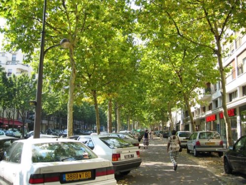
By Payton Chung from Chicago, USA (Shared street/boulevard) [CC BY 2.0], via Wikimedia Commons
Transportation is a zero-sum game: each time we improve motorist comfort or convenience by widening a road, adding a turn lane, making a road a one-way street, adding more free parking, or synchronizing traffic signals, we reduce the comfort and convenience of all other forms of travel. Transit, walking, and bicycling inevitably become less common because car travel becomes more pleasant, and pleasant car travel makes non-car travel less pleasant and more dangerous. More trips by car—rather than by transit, bicycle, or foot—lead to more gas consumption. Ironically, widened free roads, larger amounts of free parking, and other techniques to ease car travel make the experience worse for drivers as well, because the induced car trips quickly create congested road and parking conditions.
Sections 1-4 of this paper presented the rationale for a new paradigm in transportation planning in Boulder. The recommendations that follow from those sections are offered below:
- Establish a rural-to-urban transect system for land use and transportation patterns in Boulder.
- Retain or strengthen the clustering of development in existing and emerging town centers.
- De-emphasize the use of higher speed car traffic and easy car parking as a measure of community quality of life.
- End the policy of promoting motor vehicle capacity increases in street design as a means of reducing air emissions.
- Design new housing to provide a compact, walkable lifestyle in town centers and transit centers.
- Facilitate households needing fewer cars by reducing travel distances to daily needs and improving access to the transit system.
- Make car parking more efficient by de-emphasizing minimum parking requirements and moving toward maximum parking caps, unbundling the price of housing from the price of parking, allowing more sharing of parking, and pricing a larger percentage of parking.
- Give priority to pedestrians, bicyclists and transit riders for the timing of signal lights, access, safety, and speed of travel, particularly in the town center.
- Incrementally shrink the excessive allocation of space (for roads, intersections, and parking areas) given over to motor vehicles, excessive motor vehicle speeds, excessive automobile subsidies, and excessive distances to daily destinations.
- Impose a moratorium on the installation of intersection double left-turn lanes and eventually remove such configurations – particularly in the more urbanized areas of Boulder.
- Increase the use of user fees for roads and parking.
- Revitalize the traffic calming program for streets with excessive, dangerous motor vehicle speeds.
- Emphasize driver attentiveness in street design rather than encouraging driver forgiveness. Similarly, emphasize life safety rather than fire safety.
- Evaluate the conversion of one-way streets back to their historic operation as two-way streets
- Reduce regional car trips by creating a better balance between the number of jobs and the number of homes.
References
Smart Transportation and Smart Land Use
Nozzi, Dom. Road to Ruin: An Introduction to Sprawl and How to Cure It. Praeger Publishers, 2003.
Efficient Parking
Shoup, Donald (2005). The High Cost of Free Parking. Planners Press/American Planning Association.
Air Emissions
Cassady, Alison; Tony Dutzik and Emily Figdor (2004). More Highways, More Pollution: Road Building and Air Pollution in America’s Cities, U.S. PIRG Education Fund (www.uspirg.org). http://www.opr.ca.gov/docs/PreliminaryEvaluationTransportationMetrics.pdf
Gorham, Roger (2009), Demystifying Induced Travel Demand, Sustainable Transportation Technical Document, Sustainable Urban Transportation Project (www.sutp.org). Available at: http://www.sutp.org/index2.php?option=com_content&do_pdf=1&id=1461
Hymel, K. M., Kenneth A. Small and Kurt Van Dender (2010). Induced Demand and Rebound Effects in Road Transport, Transportation Research B (www.elsevier.com/locate/trb).
ICF Consulting (2005). Handbook on Integrating Land Use Considerations into Transportation Projects to Address Induced Growth, prepared for AASHTO Standing Committee on the Environment. Available at: http://www.trb.org/NotesDocs/25-25(3)_FR.pdf.
Litman, T. (2001). Generated Traffic; Implications for Transport Planning, ITE Journal, Vol. 71, No. 4, Institute of Transportation Engineers (www.ite.org), April, 2001, pp. 38-47. Available at: http://www.vtpi.org/gentraf.pdf.
Litman, T. (2010). Changing Vehicle Travel Price Sensitivities: The Rebounding Rebound Effect, VTPI (www.vtpi.org); atwww.vtpi.org/VMT_Elasticities.pdf.
Noland, R. B. and Lewison L. Lem (2002). A Review of the Evidence for Induced Travel and Changes in Transportation and Environmental Policy in the US and the UK, Transportation Research D, Vol. 7, No. 1 (www.elsevier.com/locate/trd), January, pp. 1-26.
Noland, Robert and Mohammed A. Quddus (2006). Flow Improvements and Vehicle Emissions: Effects of Trip Generation and Emission Control Technology, Transportation Research D, Vol. 11 (www.elsevier.com/locate/trd), pp. 1-14; also see http://www.cts.cv.ic.ac.uk/documents/publications/iccts00249.pdf. And https://dspace.lboro.ac.uk/dspace-jspui/handle/2134/5289)
Shefer, D. & P. Rietvald (1997). Congestion and Safety on Highways: Towards an Analytical Model, Urban Studies, Vol. 34, No. 4, pp. 679-692.
Sierra Club: http://vault.sierraclub.org/sprawl/articles/hwyemis.asp
TRB (1995). Expanding Metropolitan Highways: Implications for Air Quality and Energy Use, Committee for Study of Impacts of Highway Capacity Improvements on Air Quality and Energy Consumption, Transportation Research Board, Special Report #345 (www.trb.org)
TRISP (2005). Treatment of Induced Traffic, Economic Evaluation Notes, UK Department for International Development and the World Bank (www.worldbank.org). Available at: http://go.worldbank.org/ME49C4XOH0. Summarizes transport project evaluation methods suitable for developing country applications.
UKERC (2007). ‘Rebound Effects’ Threaten Success of UK Climate Policy, UK Energy Research Centre (www.ukerc.ac.uk); at http://www.ukerc.ac.uk/MediaCentre/UKERCPressReleases/Releases2007/0710ReboundEffects.aspx.
UKERC (2009). What Policies Are Effective At Reducing Carbon Emissions From Surface Passenger Transport? UK Energy Research Centre; at http://www.ukerc.ac.uk/ResearchProgrammes/TechnologyandPolicyAssessment/0904TransportReport.aspx.
Williams-Derry, Clark (2007). Increases in Greenhouse-Gas Emissions from Highway-WideningProjects, Sightline Institute (www.sightline.org); at http://www.sightline.org/research/energy/res_pubs/analysis-ghg-roads
Right-of-Way Reallocation
Burden, D. and P. Lagerwey (1999). Road Diets: Fixing the Big Roads http://www.walkable.org/assets/downloads/roaddiets.pdf
Complete Streets: Prince Avenue. Improving Road Efficiency. http://completestreetsprince.org/safety-by-design/improving-road-efficiency/ [accessed July 15, 2014]
Falbo, N (2013. The Traffic Analysis Results Are (Sort of) In. http://fosterunited.org/the-traffic-analysis-results-are-sort-of-in/
Gates, T. J., Noyce, D.A., Talada, V., & Hill, L. (2007). The safety and operational effects of “road diet” conversions in Minnesota. Washington, D.C.: Transportation Research Board. http://pubsindex.trb.org/document/view/default.asp?lbid=801948
Kittleson and Associates (2011). Road Diet White Paper. http://www.ashland.or.us/Files/Road%20Diets%20White%20Paper.pdf
Libby Thomas, Senior Associate, UNC HSRC (2013). Road Diet Conversions: A Synthesis of Safety Research, May 2013. http://katana.hsrc.unc.edu/cms/downloads/WhitePaper_RoadDiets_PBIC.pdf
McCormick, C. York Blvd: The Economics of a Road Diet. http://la.streetsblog.org/wp-content/pdf/york_blvd_final_report_compress.pdf
National Complete Streets Coalition (2010). Ease Congestion. http://www.smartgrowthamerica.org/complete-streets/implementation/factsheets/ease-congestion
Oregon Department of Transportation (2013). Systematic Safety Measures: Road Diet http://www.oregon.gov/ODOT/HWY/TRAFFIC-ROADWAY/docs/pdf/RoadDiets.pdf
Oregon Department of Transportation (2012). Talent Area Road Diet Analysis http://www.oregon.gov/ODOT/HWY/REGION3/docs/OR99TMRoadDietDRAFT09-04-12.pdf
Pedsafe. Lane Reduction (Road Diet) http://www.pedbikesafe.org/PEDSAFE/countermeasures_detail.cfm?CM_NUM=19
Rosales, J.A (2007). Road Diet Handbook – Overview http://www.oregonite.org/2007D6/paper_review/D4_201_Rosales_paper.pdf
Tan, C. H. (2011). Going on a Road Diet https://www.fhwa.dot.gov/publications/publicroads/11septoct/05.cfm
U.S. Department of Transportation, Federal Highway Administration. Proven Safety Countermeasures: “Road Diet” (Roadway Reconfiguration). http://safety.fhwa.dot.gov/provencountermeasures/fhwa_sa_12_013.htm
U.S. Department of Transportation, Federal Highway Administration. Evaluation of Lane Reduction “Road Diet” Measures on Crashes https://www.fhwa.dot.gov/publications/research/safety/10053/10053.pdf
Welch, T. (1999). The Conversion of Four-Lane Undivided Urban Roadways to Three-Lane Facilities. Presented at the Transportation Research Board / Institute for Transportation Engineers Urban Street Symposium, Dallas, TX, June 28-30, 1999. http://nacto.org/docs/usdg/conversion_of_four_lane_undivided_urban_roadways.pdf
Wikipedia: http://en.wikipedia.org/wiki/Road_diet [accessed July 15, 2014]
Travel Time Budget
Forbes, Gerald (1998). Vital Signs: Circulation in the Heart of the City – An Overview of Downtown Traffic. ITE Journal, August 1998.
Goddard, S.B. (1994). Getting There. The University of Chicago Press, Chicago, pg. 68.
Levinson, D., and Kumar, A. (1995). Activity, travel, and the allocation of time. APA Journal. 61 (4): 458-470. American Planning Association, Chicago. Autumn, pp. 458–70.
Manning, I. (1978). The Journey to Work. Sydney: Allen and Unwin.
Neff, J. W. (1996). Substitution Rates Between Transit and Automobile Travel. Presented at the Association of American Geographers Annual Meeting, Charlotte, N.C., April 1996.
Newman, P., and Kenworthy, J. (1989). Cities and Automobile Dependence: An international sourcebook. Gower, Aldershot, England, p. 106.
Stokes, G. (1994). Travel Time Budgets and Their Relevance for Forecasting the Future Amount of Travel. In Transport Planning Methods: PTRC European Transport Forum Proceedings. University of Warwick, pp. 25-36.
Szalai, A. (Ed.) (1972). The Use of Time: Daily Activities of Urban and Suburban Populations in Twelve Countries. Mouton, The Hague.
Wikipedia. Marchetti’s constant. http://en.wikipedia.org/wiki/Marchetti’s_constant
Zahavi, Yacov. Metropolitan Travel Survey Archive. http://www.surveyarchive.org/zahavi.html
Zahavi, Y., and Ryan, J.M. (1980). Stability of Travel Components Over Time. Transportation Research Record. 750: 19-26.
Motorist Subsidies
Delucchi, M. (Inst. of Transportation Studies, UC Davis, CA 95616) (1996). A Total Cost of Motor-Vehicle Use. Access, Spring 1996.
Ketcham, B. & C. Komanoff (1992). Win-Win Transportation: A No-Losers Approach To Financing Transport in New York City and the Region. KEA, 270 Lafayette #400, New York 10012; July 1992.
Litman, T. (1998). Transportation Cost Analysis; Techniques, Estimates and Implications. Victoria Transport Policy Institute, 1250 Rudlin Street, Victoria, BC, V8V 3R7, Canada.
Litman, T. & E. Doherty (2009). Transportation Cost and Benefit Analysis Techniques, Estimates and Implications. VTPI.
Litman, T. (2013). Whose Roads? Evaluating Bicyclists’ and Pedestrians’ Right to Use Public Roadways. 11 December 2013. Victoria Transport Policy Institute. http://www.vtpi.org/whoserd.pdf
MacKenzie, J., R. Dower & D. Chen (1992). The Going Rate: What It Really Costs To Drive. World Resources Institute, 1709 New York Ave NW, Washington DC 20006; June 1992.
Miller, P. & J. Moffet (1993). The Price of Mobility. Natural Resources Defense Council, 71 Stevenson l #1825, San Francisco CA 94105, 415-777-0220; Oct 1993.
Office of Technology Assessment (1994). Saving Energy in U.S. Transportation. U.S. Congress, OTA-ETI-589.
Sierra Club. America’s Autos On Welfare in 2010: A Summary of Subsidies. http://vault.sierraclub.org/sprawl/articles/subsidies.pdf [accessed July 15, 2014]
One-Way Streets
Baco, M.E. (2009). One-way to Two-way Street Conversions as a Preservation and Downtown Revitalization Tool: The Case Study of Upper King Street, Charleston, South Carolina. http://www.ci.hillsboro.or.us/modules/showdocument.aspx?documentid=3828
Brovitz, Ted (2000). Converting Downtown Streets from One-Way to Two-Way Yields Positive Results. The Urban Transportation Monitor.
Chiu, Yi-Chang, Xuesong Zhou, and Jessica Hernandez (2007). Evaluating Urban Downtown One-Way to Two-Way Street Conversion using Multiple Resolution Simulation and Assignment Approach. Journal of Urban Planning and Development 133, no. 4 (2007): 222.
Ecologically Sustainable Design Pty Ltd (2005). Summary Report on the Conversion of One-Way Streets to Two-Way Streets in North American Town Centres. Victoria, Australia: Prepared for the Midland Redevelopment Authority. Available by request through Ecologically Sustainable Design Pty Ltd.
Edwards, J. D (2002). Converting One-Way Streets to Two-Way: Managing Traffic on Main Street. Washington, D.C.: The National Trust’s Main Street Center. http://www.preservationnation.org/main-street/main-street-news/2002/06/converting-one-way-to-two-way.html
Walker, G. Wade, Walter M. Kulash, and Brian T. McHugh (1999). Downtown Streets: Are we Strangling Ourselves on One-Way Networks?
The mission of PLAN-Boulder County is to ensure environmental sustainability, promote far-sighted, innovative, and sustainable land use and growth patterns, preserve the area’s unique character and desirability, and reduce our carbon footprint and environmental impact.
PLAN-Boulder County envisions Boulder County as mostly rural with open land between cities and towns that support working farms on good agricultural land and provides for conservation of critical habitats for wildlife and native flora. Within Boulder and neighboring communities, urban boundaries limit sprawl and growth is directed to meet community goals of housing affordability, diversity of all kinds, environmental sustainability, neighborhood identity, and a high quality of life. PLAN-Boulder County further supports green building practices that minimize energy use and greenhouse gas emissions. In addition, PLAN-Boulder County supports a more balanced transportation system that actively promotes public transit, bicycle commuting, and pedestrian travel, and provides for smarter use of automobiles.
The opinions expressed in this paper are those of the authors and do not represent the views of the various city and county organizations with which the authors are affiliated.
Dom Nozzi, principal author of this paper, is a member of the PLAN-Boulder County Board of Directors and the City of Boulder Transportation Advisory Board. Mr. Nozzi has a BA in environmental science from SUNY Plattsburgh and a Master’s in town planning from Florida State Univ. For 20 years, he was a senior planner for Gainesville, Forida and was also a growth rate control planner for Boulder. He has authored several land development regulations for Gainesville, has given over 90 transportation speeches nationwide, and has had several transportation essays published in newspapers and magazines. His books include Road to Ruin and The Car is the Enemy of the City. He is a certified Complete Streets Instructor providing Complete Streets instruction throughout the nation.
Pat Shanks, Jeff McWhirter, Alan Boles and Scott McCarey also contributed to this paper.


 tested) buildings built with traditional designs.
 the building is loved, it is much more likely to last for generations, because citizens will be more likely to defend it from demolition. Time-tested buildings, by definition, are the most loved. I am completely convinced that “innovative” modernist buildings will, in nearly all cases, not stand the test of time, and be demolished relatively soon. To build buildings that are so unloved that they are soon demolished is dreadfully wasteful.
 brought to us by using “energy slaves” – using cheap energy to do work for us, such as using a leaf blower rather than a broom (or using motorized travel versus walking or bicycling).


