Tag Archives: land development regulations

Debating Whether Transportation Drives Land Use with My Gainesville Planning Department Supervisors

By Dom Nozzi

February 17, 2000

I had a loud debate with my Gainesville, Florida planning department supervisors yesterday on what the Land Use portion of Gainesville’s Long Range Plan should say.

I pointed out that because transportation drives land use, it is hopeless, in the long run, for local government to fight proposed rezonings from single-family residential to non-single family on major, hostile streets. None of them agreed with me at all, and believe the City should continue our long, hopeless fight against rezoning proposals from single-family to non-single family on hostile streets. This is maddening, and obviously being colored by recent NIMBY attacks against the City.

After the meeting, I sent the planning manager excerpts from the West Palm transportation element. He responded with this:

Dom, I didn’t read all of this but I generally agree with the part I read. Transportation travel land use, and bad land use decision drive people away also.  If the Street is bad and the Land use is bad what do you think will happen.  For Gainesville the Streets are bad and the Land use is no so bad, so lets change the street and keep the land use. [this is the verbatim, uncorrected transcript of his message to me]

I responded to those comments with this:

“Glad you agree with West Palm and folks like Walter Kulash, who would say exactly what I and West Palm Beach would say on these issues. My main point: We are fooling ourselves and doomed to a life of permanent, never-ending battles with people who want to rezone single-family residential land that they own and cannot use as single-family residential land use due to the road.

“Granted, there are a few who could live in a single-family residential home and put up with the noise and reduced property value. Forty years from now, if we do not fix our arterials to make them more livable, we will, though incremental zoning changes, have those streets lined with offices and multi-family residential and retail. And over those 40 years, we will have a bunch of planners burned out on fighting those never-ending battles.street without on street parking

“In the long term, as Kulash points out, no force on earth – not even five no-growth advocates on the City Commission — can stop that incremental change. Yes, we can succeed, in the short term, in keeping the single-family. But that will only mean that we’ll have a bunch of vacant homes, and depressed property values.

“The best we can realistically hope for, in the long run, if we don’t fix the streets, is land use that makes sense for major streets (according to what the market wants), and helps transit, while minimizing strip commercial. That is why I think we should give some consideration to favorable recommendations on petitions that request going to office use or multi-family use (but not retail).

“Again, I am not recommending that we initiate the land use changes (that will inevitably come) — even though that would be most fair for suffering single-family property owners along major streets. Our message must be: “Either fix the street, or be fair and honest by realizing we are going to get incremental conversion away from single-family.”

West Palm Beach FL has shown clearly what can happen overnight (dramatic land use improvements and property value increases) when the street is fixed.

My comments to the Gainesville Comprehensive Long Range Planning Chief:

“I’ve not had a full night’s sleep for weeks, and have recently developed a severe case of insomnia. So when you see me dozing off at future staff meetings, you’ll understand.

“And it is not just student noise that is out of control. It is also emergency vehicles, vacuum trucks, police helicopters, etc… With regard to SW 13th Street (a major state highway running north-south through the middle of Gainesville), let me again try to make clear that the public sector, short of doing a major change to the street (such as we’re proposing for SW 20th Avenue), has nearly no meaningful way to affect the land use market. The Land Use plan I wrote for Gainesville, for example, will have a future land use map that merely adopts what is on the ground already, with a few minor tweaks based on what citizens have asked for on their individual property and we have agreed to. But even IF we could make wholesale, visionary changes to our land use map, such changes would have little meaning (or fairness) unless they are attuned to what the market calls for in those locations — and us planners would not be doing work to determine market feasibility of changed designations. Again, transportation drives land use. So unless we make radical changes to SW 13th, all we can expect is uses that are consistent with that sort of highway.

“Personally and frankly, I think converting SW 13th to a “4-lane urban street” is an oxymoron. Not to say that I’ve given up on 13th, because I think we’ll ultimately return to our senses and make it a 2-lane. I don’t know enough of the details to know what Chapel Hill has done, but I’m fairly certain that they are things we cannot duplicate anytime soon — such as buildings up to the street (which I would oppose on a 4-laner without on-street parking, since it is unfair to the business).

“I would have to see why Chapel Hill works well. I do not think it is feasible to slow traffic on a 4-lane state highway because FDOT would not allow it. It can happen with a 2-lane state highway due to things like congestion and a narrow street profile that does not create the illusion of a high-speed highway.

“More so than most, I can envision such a 13th Street corridor fairly easily. Given time and vision and courage, it can be wonderful. Many people consider me a pessimist on certain things, but hypocritically are extreme pessimists on things I’d like, such as a walkable city. I would strongly support what you suggest be done on 13th. But I do not believe it (a four-lane urban street) would dramatically change 13th to make it a good market for higher density residential or pedestrian vibrancy. Call me a pessimist, but I’m convinced we MUST remove travel lanes to make SW 13th work. And isn’t that necessary if we are going to install on-street parking there?

“But are we not skirting around the key effort? Don’t we need to admit that we need to slow the growth of UF, get more on-campus housing, or get better code enforcement (or a combination of such things)? I’m sorry, but I just don’t see a realistic way to transform SW 13th the way you and I know it needs to transform someday.

“In my humble opinion, we cannot realistically expect good redevelopment along SW 13th as long as FDOT forces it to remain a high-speed highway. I just don’t see colored crosswalks, landscaping, or wide sidewalks dramatically changing things. Don’t we, for example, have some colored crosswalk pavers out on Newberry Road near Oaks Mall now. Has that meant anything at all?

“I like your enthusiasm and ideas about Westgate, too, but am not sure even a Dover/Kohl charrette could do much unless the owners of the center felt the plaza was collapsing economically. There are things we might be able to do with an overlay district I’ve outlined in my urban design toolbox (which has been pulled from the urban design plan I wrote because it is “too new urbanist”). I’m hoping we can adopt such an overlay for places like Westgate, but the change will be painfully slow unless the plaza is torn down. That is the only way we can get the buildings re-configured in a proper way.

“Thanks for your comments, good suggestions and concern.”

More of my thoughts expressed to the Comprehensive Long Range Planning Chief:

“Probably our most enormous problem with ‘fixing’ this area is that we will not be able to do it as long as it remains a high-speed, 5-lane state highway. We can only save it if we can take out 2 travel lanes, but I suspect this is not politically feasible, given our FDOT people and our commission. SW 13th already has a bike lane that is excellent for bike commuters, but it would be interesting to create an off-street greenway trail there. Any opportunities? Any way to extort such a thing? Also, the existing buildings are way too far off the street to make for quality urbanism. We’d need code requirements that say that any reconstruction or new development must be on the sidewalk. Again, probably not politically feasible.

“So without removing travel lanes and without pulling buildings close, we have a long-term, huge problem. And this is not even to mention the fact that our residential density and commercial intensity along there is way too low. Once again, all we can do as the public sector to move the market in that direction is to remove travel lanes.

“I think we’d probably need some special, non-Traditional City [walkable Gainesville regulations I wrote for downtown] overlays for the two areas, and perhaps hire Dover to do the plan. Retrofitting such miserable places is a monstrous job that requires a lot of political courage and staff time. (which is why people like Dover are helpful) I could do overlays for the areas, but it will take a LONG time for them to transform those areas.

“An example of the problem of Trad City applied to Westgate: Would it be feasible and appropriate, without an internal street plan, to require all redevelopment there to demolish the strip store and put it up on 34th or University? Seems like we first need to adopt an internal street plan, and then find the courage to get the plan adopted and conformed to. And then have enough redevelopment interest to see meaningful redevelopment over a reasonable period of time.”


Leave a comment

Filed under Politics, Road Diet, Sprawl, Suburbia, Transportation, Urban Design

NIMBY Screamers Are Their Own Worst Enemies

By Dom Nozzi

September 16, 2017

Ironically, those people who scream the loudest that developers will not ever develop European charm are the very same people who ALSO scream that developers must (1) PROVIDE MORE PARKING!!!!!!! (2) PROVIDE MORE OPEN SPACE AND HUGE SETBACKS!!!! (3) ONLY ALLOW PROJECTS THAT HAVE VERY, VERY LOW SUBURBAN DENSITIES!!!!!!!!!!! (4) DON’T BUILD BUILDINGS TALLER THAN ONE STORY!!!!!

Each of those screaming demands make it impossible for a developer in Boulder to build European charm.

So what do such people want? European charm? If so, stop screaming for things that make that charm impossible.

There is zero reason why Boulder cannot require new development in Boulder to be built with European charm.

EXCEPT the reason that so many Boulder citizens apparently hate European charm even though they say otherwise.

Which is it, screamers? Do you want European charm or not?

Who needs enemies when we have ourselves?

Tremosine Italy


Leave a comment

Filed under Politics, Road Diet, Sprawl, Suburbia, Transportation, Urban Design, Walking

Inverse Relationship Between Buildings and the Splendor of the Local Environment?


By Dom Nozzi

March 18, 2017

I have heard it said that there is — in America at least — an inverse relationship between the beauty of architecture and overall community design in a community, and the beauty of the surrounding natural landscape. The more spectacular the surroundings, the more mediocre the architecture and community design.

If true, I would speculate that this can be said because a community fortunate enough to be within a gorgeous natural setting having a tendency to single-mindedly focus on protection of the spectacular natural landscape as the be all and end all of community beauty.

But community beauty is far more than protecting the natural beauty (as important as that is). The community must ALSO not lose sight of the extreme importance of adopting regulations that obligate the construction of beautiful buildings and neighborhoods and streets.

I believe that Boulder has failed to sufficiently focus on these aspects of community beauty.boulder flatirons

Leave a comment

Filed under Environment, Urban Design

Squandering Leverage in Town Planning


By Dom Nozzi

February 18, 2003

Florida has a community growth management law containing a “concurrency” rule: The rule requires that new development demonstrate that existing facilities are adequate to absorb new impacts from the development, or that such facilities be provided by the developer if such facilities are not in place.

As Walter Kulash has pointed out, such a rule might be fine for parks or sewers, but applying it to roads is counterproductive in the state efforts to discourage sprawl (and to promote livability).

Because available road capacity tends to be found in outlying areas, and Florida strives to minimize sprawl, Florida began granting cities the option of establishing “Transportation Concurrency Exception Areas” (TCEAs) in urban areas as a way to counter the fact that the state concurrency laws, in part, promote sprawl.

TCEA approval by the State obligates cities to establish transportation mitigation rules. In most Florida cities, such rules include a menu of mitigation options such as bus stops, sidewalks, etc. A developer must select from the options to achieve a point score that exceeds the minimum required by the city.

I believe that cities in Florida reacted to this TCEA option by “giving away the store” on their TCEA rules. It is very rare for a community in Florida to have any leverage over a development (in which we can say that we would want various conditions placed on a project in order for it to be approved). Florida communities have been a doormat for so long — low taxes, weak regs, no impact fees, etc.

But suddenly, TCEA gave Florida communities their first real opportunity to have some leverage: “We’ll only approve your proposed development project IF you provide X, Y, and Z with your project.” Because road concurrency is the only real concurrency rule that developers and cities care about (park concurrency, for example, is largely ignored — happy cars are the only real concern in Florida…), providing exceptions to road concurrency is, potentially, an EXTREMELY attractive, powerful leverage tool.

For the first time ever, Florida communities would have the leverage to demand quality urban design.

Unfortunately, nearly all Florida communities squander the TCEA opportunity. Nearly all of the TCEA mitigation menu options adopted in Florida are either trivial, do-nothing, band-aid features (more landscaping, sidewalks that no one will use, etc.), or are actually counterproductive (adding turn lanes or bus bays, for example).

Had I been in charge, the approach would have been quite different. “We’ll grant you a road exception. In exchange, you will grant us compact, walkable urbanism.”


Leave a comment

Filed under Sprawl, Suburbia, Transportation, Urban Design

An Unintended Consequence of Development Regulations Consistent with Long-Range Plans


By Dom Nozzi

February 26, 2003

Florida adopted a rule that requires all cities and counties to adopt a 10-year comprehensive plan every 10 years, and also requires local governments to make their land development regulations consistent with their (hopefully) visionary long-range comprehensive plans.

Sounds, at first, like a wonderful idea. After all, isn’t it true that lack of consistency between the two documents is an important cause of a failure to implement the long-range plan vision?cover2-2

But this consistency is not necessarily cause for celebration, at least from what I learned about watching it work (or not work) in Florida. Sadly, there is an unintended consequence.

Because comprehensive plans must be consistent with land development regulations, communities quickly realize that such long-range plans can be quite powerful in shaping development regulations, which makes the development community very nervous.

The solution?

Ensure that the adopted long-range plan is relatively reactionary.

An example of this is that land use designations adopted in the comprehensive plan tend to merely acknowledge the status quo – the long-range land use map simply mimics the existing land uses and zoning already in place. There is therefore little or no “vision” in the adoption of the comprehensive plan land use map. In my community, for example, our 10-year comprehensive plan update simply made a few trivial tweaks to our existing land use designations – designations that were originally and largely established based on existing zoning and uses for parcels in the city.

Note that the above occurred in my community DESPITE the fact that the majority of city commissioners who voted to adopt our comprehensive plan were visionary new urbanists.

In retrospect, perhaps there is something to be said for a comprehensive plan that is “advisory” rather than “mandatory”.

The former creates more of a likelihood that the plan will have a vision.


Leave a comment

Filed under Politics

What Direction Should the State of Florida Take With Regard to Local Government Planning?

By Dom Nozzi

September 25, 2003

The State of Florida contains an agency called the Department of Community Affairs, which provides directives and guidance to city and county governments in Florida regarding town planning, transportation and land development. That agency therefore plays a crucial role in how development and transportation should occur in Florida.

What should this guidance consist of?

As a 20-year long-range town planner in Florida, here are my thoughts on the matter.

First, planning directives from the state planning agency need to be more directive than to just call for communities to establish a “vision.” But instead of taking a heavy-handed approach in which the state dictates how communities should be developed, there should be a strong statement that calls for communities to:

(a) Create plans and regulations that promote lifestyle choices. All communities must provide ample opportunities for living an urban, suburban, or rural lifestyle. Currently, nearly all communities only allow for the suburban choice. We must be clear that one size does not fit all. We need a tiered regulatory system that applies appropriate regulations for each lifestyle choice, instead of providing only suburban design regulations. We need to make urban and rural lifestyles legal again (in appropriate locations).urban-to-rural-transect-Duany-Plater-Zyberk-sm

(b) Create a transportation system that is rich in transportation choices. Again, this needs to be a tiered approach where one size does not fit all locations. In core (urban, compact) areas, the pedestrian is the design imperative. Streets are modest in size, calm in design speed and no more than three lanes in width. Roads get progressively larger and higher in design speed as you move outside of core. The Florida Department of Transportation (FDOT), in particular, needs to radically change their approach to design so that state roads are context-sensitive when going through communities. FDOT must become a helpful partner with local communities, instead of an adversary only looking out for the needs of the state.

In many communities, being serious about controlling sprawl and protecting or restoring quality of life will require a long-term healing process. Damage wrought in the past by building monster high-speed roads will often need to be incrementally reversed by putting many of these roads on a diet (ie, removing unnecessary, toxic, dangerous travel lanes).

In the interim, as communities struggle to correct the design of their streets and roads, an urban growth boundary will probably be required. Without a strong boundary, no plans, regulations or strong elected officials can stop the sprawl tidal wave induced largely by big roads in a community.

(c) Many important efforts are necessary to reverse our long-standing pattern of being our own worst enemies. The Florida Growth Management Act (which dictates rules for plans that local governments in Florida must adopt) needs to be revised so that road “level of service” (the level of congestion found on a road) is not applied in urban areas. The State concurrency rule that obligates level of service for urban roads is a powerful sprawl engine (because “adequate” road capacity tends to only be found in outlying areas rather than within towns).

In addition, public schools must end the practice of inducing sprawl by curtailing the widespread construction of new schools in outlying areas. An important element is this is to revise school standards that make walkable, in-town, neighborhood-based schools difficult or impossible (such as large ballfield requirements).

Large emergency service vehicles must not dictate excessive road design standards by being the standard that engineers use to design roads (the “design” vehicle). Doing so promotes high and dangerous car speeds.

Similarly, modest, human-scaled streets and building design must be made legal again in the urban portions of a community.

In sum, a strong stand must be taken by planners that we stand for CHOICE, and that one size does not fit all.


Leave a comment

Filed under Politics, Road Diet, Sprawl, Suburbia, Transportation

Transportation Comes Before Land Use


By Dom Nozzi

May 21, 2004

The condition of the street determines what happens alongside it. I agree with urbanist Robert Gibbs when he says it is unfair to require a business to abut a streetside sidewalk when the street does not have on-street parking. When street carrying a relatively large volume of cars lacks on-street parking, the street is too hostile to have buildings butt up to it. I don’t at all blame businesspeople for pulling away from the street when the street is a “car sewer.”street without on street parking

In sum, either a relatively large street without on-street parking is forever to be a strip commercial “lost land” because it is impractical to shrink its size, or it needs to be made livable (largely with on-street parking and removal of travel lanes – both of which create a more human-scaled, slower-speed environment) before you start requiring buildings to behave themselves by pulling up to the sidewalk and having an entrance face the street.

If we try to force buildings to be pedestrian-friendly BEFORE the street is rehabilitated, we risk giving urbanism a black eye. We understandably increase the likelihood of a political firestorm of businesspeople SCREAMING to elected officials not to force their buildings up on the sidewalk.

Sadly, we fail to heed the above warning, and instead we almost always keep our fingers crossed and hope — in desperation — that we can fix the land development regulations or redo the urban design along a street before we fix the street, because fixing the street is (usually rightly) seen as being a non-starter (at least in our lifetimes), and the former is WAY more do-able.

To put land use before transportation is an ineffective path of least resistance.


1 Comment

Filed under Road Diet, Transportation, Urban Design

Regulating Big Box (Large Format) Retail

By Dom Nozzi

March 2007

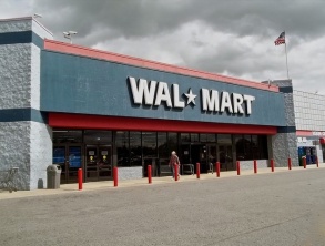
In 2006, I was assigned the task of preparing Big Box (large format) Retail land development regulations for the City of Gainesville, Florida. My hard work researching this effort unfortunately went into the dustbin, as I believe the City opted to simply mimic Walmartthe much more lax and largely ineffective Alachua County regulations for such retail.
Therefore, as a way to rescue my suggestions from oblivion, the following is what I recommended Gainesville adopt as regulations to manage new Big Box Retail.

Establish 3 “context zones” for large format retail with design standards that become increasingly oriented toward the use of relatively small, human-scaled dimensions for things such as block size, street and driveway width, and required parking. This method would be focused on delivering a quality public realm as the location shifts from a highway/sprawl zone to a walkable urbanity zone.

The three context zones for calibrated regulations:

  1. Town Center and surrounding, relatively walkable neighborhoods.
  2. Areas outside of #1 and #3.
  3. Properties adjacent to major, high-speed, multi-lane roadways.

The primary reason for three context zones is that if (as is so often the case) one-size-fits-all regulations are used, the inevitable result is mediocrity, since the design features that urban designers seek in walkable areas are inappropriate, and therefore disregarded and ultimately abandoned in drivable areas.

Eventually, the one-size-fits-all approach means that walkable areas get only what makes sense in drivable areas (lowest common denominator regulations). In other words, such walkable, compact areas get nothing that promotes or protects walkability. Instead, it gets design that undermines walkability. For example, since it is nonsensical to require large format retail to place its parking behind the building or install first floor windows when near the Interstate, such essential design features end up not being required in the town center either.

Proposed Context-Sensitive Regulations:

In zone 1, the maximum size for large format retail is 15,000 square feet. Low-speed street and intersection dimensions and geometry required. Building setbacks and facades based on context of neighborhood.

In zones 2 and 3, the threshold is 50,000 square feet.

Connectivity to adjacent properties required.

Abandoned large format retail buildings (very common for such a retailer to abandon a building) must be demolished and have site restored.

Mixed use residential required.

A long list of encouraged and discouraged architectural features to be used in design review.

At least two public realm amenities (such as a pedestrian plaza or clock tower) is required from a list provided.

The result of this calibrated approach is more calibrated, appropriate, fair, and politically sustainable design regulations for Big Box Retail.

Leave a comment

Filed under Urban Design

Local Government Development Regulations as a Recipe for Sprawl


By Dom Nozzi

August 5, 2005

I worked as a town planner for Gainesville, Florida for 20 years. Like most cities, Gainesville’s plans, policies, regulations, elected officials, and planning staff proclaim that the City supports compact development, more bicycling and walking and transit use, and less sprawl.

Tragically, however, Gainesville has adopted a long list of development regulations that require dispersed, drivable suburbia. Examples are nearly endless.

Gainesville’s building setbacks, like in nearly all cities, are gigantic and desperately fought for by staff.parking_sea

Gainesville’s parking requirements, like in nearly all cities, are ENORMOUS, and staff aggressively fights for as many parking spaces as it can extract from the developer. To do this is to be a “hero” for nearby neighborhoods concerned about “spillover” parking – one of the great bugaboos in American town planning.

Nearly everyone in Gainesville — including most public works staff — join the Florida Department of Transportation in fighting for HUGE intersections and wider roads (I recall that my proposal to limit use of turn lanes downtown in the Transportation Element I prepared for the City was shot down, and my 4-lane maximum road size was subsequently removed after the plan was adopted.

Gainesville has over 33 zoning districts. More single-use districts means more sprawl.

Sidewalk requirements don’t really do much to discourage sprawl when located in suburbia, because distances are too large to encourage people to walk to destinations. They just ease our guilty conscience.

Maximum “floor area ratio” (FAR) requirements (which set the maximum square footage of building that can be built on a property) are extremely low. Low FARs strongly discourage walking, and undercut the need for creating an urban fabric that possesses human-scaled charm.

Minimum lot widths are excessive. Relatively small lot widths promote vibrant, sociable, convenient walkability.

Maximum building height limits are nearly always less than 5 stories. As such, compact urbanism is extremely difficult to achieve.

The City adopted a huge and growing “transportation concurrency exception area” (TCEA). This was done when it was realized that requiring developers to show that “adequate” road capacity was available for the new car trips the development would produce was counterproductively promoting car-oriented sprawl. But instead of adopting a TCEA that covered only the relatively discreet downtown, Gainesville adopted a TCEA that applied to the entire city – including suburban locations.

Which promotes sprawl.

And even if it properly only applied to the downtown, it would still have been unhelpful because it did not effectively require any form of meaningful compact urban design. To correct this, the City should have only been granting a TCEA if the City was getting urbanism in exchange for exception. As it is, all the City got was what amounted to little more than a few shrubs for landscaping.

Overall, Gainesville – like nearly all cities in America – has adopted land development regulations that ensure a future of unlovable, car-happy sprawl.

How odd, since the plans and elected officials and staff always seem to be united in opposing sprawl…

Leave a comment

Filed under Sprawl, Suburbia, Transportation, Urban Design

Essential Ingredients for a Walkable, Compact Town Center


By Dom Nozzi

December 20, 2013

I attended a joint citizen board meeting regarding “Sustainable Streets and Centers” in Boulder, Colorado. Here are my thoughts about necessary strategies.

Assumptions

  • Boulder has adopted a clear vision for one or more newly emerging walkable, compact centers in locations such as East Arapahoe Road, Colorado Street, and East Boulder, and intends to use effective tactics to induce the creation and sustainability of such centers.
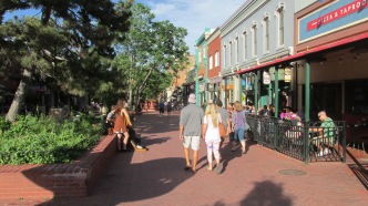
  • People that desire to live in walkable, compact living arrangements seek a setting that is conducive to such a lifestyle. That setting features low-speed, narrow and human-scaled streets and intersections, very short walking distances to most destinations, buildings pulled up to the sidewalk to create enclosure, and a vibrant experience (in contrast to deadening expanses of parking and large building setbacks). The market for higher density housing will be very weak and unsustainable if such a walkable setting is not provided.
  • 15-minute neighborhoods are an important Boulder objective, which will require the creation of a relatively large number of centers.
  • The objective for centers is a drive to rather than drive through experience, a park-once setting, and a design that makes the pedestrian the design imperative.

General comments

First, strive to use words that resonate and are understandable to non-professional Boulder citizens. Terms such as “multi-way” or “activity center” or “alternate modes” or “corridor” are confusing, uninspiring, and negative. Second, when visioning or seeking comments from citizens, it is important that citizen comments be guided and informed by skilled design professionals (such as Dover-Kohl) who are skilled in presenting information in an understandable, inspiring way (particularly through use of quality graphics). Third, existing housing, employment, or land use patterns should not necessarily dictate visions if such patterns conflict with Boulder objectives. Fourth, the needs or convenience of regional commuters should not trump the low-speed, vibrancy, pedestrian scaled needs of Boulder’s centers.

Toolbox of Strategies that are Essential in Creating a Walkable, Compact Center

(somewhat different toolboxes are needed for other lifestyle zones – “transect zones” – in Boulder)

Land Development Regulations:

  • Motor vehicle parking is behind buildings.
  • Shorter blocks via cross-access pedestrian ways between buildings.
  • Mixed-use zoning to reduce walking/biking distance, and increase 24-hour vibrancy and safety.
  • Relatively high residential densities and commercial intensities.IMG_3045
  • Remove any regulatory barriers to infilling existing parking with buildings.
  • Do not allow gas stations at intersections.
  • Convert parking minimums to parking maximums. Require that the price of parking be unbundled. Increase allowable shared use and leased parking opportunities.
  • Relatively modest building setbacks. At intersections, a sense of place is achieved by requiring buildings to abut the back of sidewalks.
  • Exemption from landscaping requirements.
  • Relatively small minimum lot sizes.
  • Relatively small signs required by the sign ordinance (to help signal a low-speed, pedestrian scaled setting).
  • Proactively overlay a street grid with small block sizes before development is proposed.
  • Do not allow fences to cut off non-street access to adjacent parcels. Fences used should not exceed three or four feet in height along a sidewalk.
  • Emphasize multi-family housing rather than single-family housing in centers and along major streets.
  • Consider requiring at buildings at least two-stories in height for more of a sense of place, a sense of enclosure, mixed use opportunities, and better adaptability to change over time.

Infrastructure

  • Shorter street blocks (200 to 500 feet max).
  • When streets passing through the proposed center are 4 lanes or more in size, they need to be necked down (road dieted) to no more than 3 lanes.
  • Intersections must be kept relatively small in size so that they are pedestrian-scaled. No more than one turn lane in a given direction, relatively narrow travel lanes, and small turning radii.
  • Continuous left turn lanes are to be discouraged. Raised medians with turn pockets are to be encouraged.
  • Raised crosswalks when feasible and appropriate.
  • Street (including lane width) and turning radii dimensions are small and slow-speed.
  • Street lights should be pedestrian-scaled so that light bulbs are no more than 14 feet in height. Taller lights create a highway ambiance and induce higher car speeds.
  • Bus bays are inappropriate in a compact, walkable center due to loss of pedestrian scale and increased pedestrian crossing distance.
  • Sidewalks have straight, rectilinear trajectories rather than curvilinear, suburban trajectories. Curvilinear trajectories, by adding unnecessary distances to walking, are annoying and patronizing to pedestrians. They are mainly benefiting motorists, who obtain a more pleasing view as they drive along a street with curving sidewalks. They also increase the likelihood of dirt cowpaths being formed by pedestrians seeking the shortest route.
  • On-street parking is allowed and priced.
  • Consider visually prominent gateway features at the entrances to centers to clearly signal to motorists that they are entering a low-speed, walkable setting that requires attentiveness.


Leave a comment

Filed under Sprawl, Suburbia, Transportation, Urban Design, Walking